Area Overview for IP1 2HA
Photos of IP1 2HA


Area Information
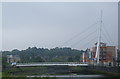
Living in IP1 2HA means inhabiting a tightly packed residential cluster in east England, where 2102 people reside across just 1148 square metres. This high population density creates a compact, closely knit community, though the area’s small size means it is not a sprawling suburb. The postcode is bordered by practical amenities, including five retail outlets such as Tesco St. and Farmfoods Westbourne, and five rail connections, including Ipswich Railway Station. Daily life here is shaped by proximity to these hubs, though the area’s character is defined by its modest scale. With no major natural or protected sites nearby, the focus is on local infrastructure. The median age of 47 suggests a mature population, with adults aged 30–64 forming the core demographic. For those seeking a quiet, manageable environment with immediate access to shops and transport, IP1 2HA offers a straightforward, no-frills lifestyle. However, the high crime risk score of 20/100 indicates a need for caution, even as broadband connectivity is rated excellent at 100. This area is not for those seeking luxury or expansive spaces, but it suits those prioritising convenience and practicality.
- Area Type
- Postcode
- Area Size
- 1148 m²
- Population
- 2102
- Population Density
- 4201 people/km²
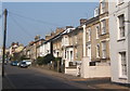
The property market in IP1 2HA is defined by its low home ownership rate of 26%, which indicates that the majority of residents are renters rather than homeowners. The accommodation type is predominantly flats, suggesting a lack of larger homes or detached properties. This makes the area unsuitable for those seeking spacious or traditional housing. The small size of the postcode—just 1148 square metres—means the housing stock is limited, and the immediate surroundings likely offer few alternatives. For buyers, this presents a challenge: the area is not a strong market for owner-occupation, and the focus is on rental properties. The high population density of 1.8 million people per square kilometre further reinforces the idea of a tightly packed, possibly overcrowded environment. Those considering purchase should weigh the limited housing options against the area’s practical amenities, such as nearby rail links and retail outlets. However, the low home ownership rate and flat-dominated market suggest that this is not a region for those prioritising property investment or long-term equity growth.
House Prices in IP1 2HA
No properties found in this postcode.
Energy Efficiency in IP1 2HA
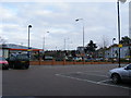
Residents of IP1 2HA have access to a range of nearby amenities, including five retail outlets such as Tesco St., M&S Ipswich, and Farmfoods Westbourne. These shops provide convenience for daily errands, though the area’s compact size means there is no sprawling commercial district. The presence of multiple rail stations, including Ipswich Railway Station and Westerfield Railway Station, enhances mobility for commuting or travel. However, the data does not mention parks, leisure facilities, or dining options, so the area’s lifestyle is likely centred on practicality rather than recreation. The high population density and focus on retail and transport suggest a community prioritising functionality over leisure. For those who value proximity to shops and rail links, IP1 2HA offers convenience, but those seeking expansive green spaces or cultural amenities may find the area lacking in these aspects.
Amenities
Schools
The schools nearest to IP1 2HA include two primary schools: St Matthew’s Church of England Voluntary Aided Primary School, Ipswich, and St Matthew’s Church of England Primary School, Ipswich. Both are primary schools, with the latter holding an Ofsted rating of ‘good’. This mix of school types suggests a focus on early education, though no secondary schools are listed in the data. For families with young children, these schools provide accessible options, though the absence of higher education institutions may require commuting for secondary schooling. The ‘good’ rating at one school indicates a standard of education that meets regulatory benchmarks, but without further data on performance or facilities, it is difficult to assess their broader quality. Parents should consider the proximity of these schools to their homes, as well as the need for additional educational resources beyond primary level.
| Rank | School | Type | Entry gender | Ages |
|---|---|---|---|---|
| 1 | St Matthew's Church of England Voluntary Aided Primary School, Ipswich | primary | N/A | N/A |
| 2 | St Matthew's Church of England Primary School, Ipswich | primary | N/A | N/A |
Explore more schools in this area
Go to Schools tabDemographics
The community in IP1 2HA is predominantly composed of adults aged 30–64, with a median age of 47. This suggests a population skewed towards middle-aged individuals, likely established professionals or families. Home ownership is low at 26%, indicating that a significant portion of the housing stock is rented. The accommodation type is almost entirely flats, reflecting a lack of larger homes or detached properties. The predominant ethnic group is White, with no data provided on other demographics. The high population density of 1,831,777 people per square kilometre underscores the area’s compact nature, which may influence social dynamics and community interaction. While no specific deprivation data is listed, the low home ownership rate and high density could imply economic pressures or a focus on rental affordability. For buyers, this demographic profile suggests a market driven by tenants rather than long-term homeowners, with housing choices limited to flats in a closely packed environment.
Household Size
Accommodation Type
Tenure
Ethnic Group
Religion
Household Composition
Age
Household Deprivation
NS-SEC
Explore more demographic insights in this area
Go to Demographics tabPlanning
Planning Constraints
- Flood RiskPremium
- Ramsar Wetland SitesPremium
- Area of Outstanding Natural BeautyPremium
- Protected Nature ReservePremium
- Protected WoodlandPremium
- Crime RiskPremium