Area Overview for IP1 2AS
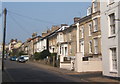
Photos of IP1 2AS


Area Information
IP1 2AS is a compact residential postcode in England, covering just 4,254 square metres and home to 1,405 residents. Its high population density of 330,292 people per square kilometre reflects its small, tightly packed nature. This area is not a sprawling suburb but a focused cluster of homes, likely situated near urban infrastructure. Living here means proximity to amenities, with five retail outlets including Tesco St. and M&S Ipswich within practical reach, and five rail connections such as Ipswich Railway Station. The area’s character is defined by its density and accessibility, making it suitable for those prioritising convenience over space. While it lacks natural reserves or protected landscapes, its location near major transport hubs and retail centres suggests a practical, commuter-friendly lifestyle. The median age of 47 and prevalence of adults aged 30–64 indicate a mature, stable community, though the 17% home ownership rate points to a mix of renters and long-term residents. For buyers, this area offers a snapshot of urban living in a small, well-served postcode.
- Area Type
- Postcode
- Area Size
- 4254 m²
- Population
- 1405
- Population Density
- 3604 people/km²
The property market in IP1 2AS is characterised by a low home ownership rate of 17%, suggesting that the majority of housing stock is rented rather than owner-occupied. Flats are the predominant accommodation type, which aligns with the area’s high population density and compact footprint. This indicates a market skewed towards rental properties, likely catering to professionals or commuters seeking short-term or flexible housing. The small area size and limited data on property types mean buyers should consider the surrounding regions for more options. For those interested in ownership, the low home ownership rate might signal limited availability or a focus on long-term rental investments. The flat-dominated stock also implies a need for buyers to assess suitability for family living or long-term residency. Given the area’s size, property searches may need to extend beyond IP1 2AS to find diverse housing choices.
House Prices in IP1 2AS
No properties found in this postcode.
Energy Efficiency in IP1 2AS
Living in IP1 2AS provides access to a range of local amenities within practical reach. The area includes five retail outlets, such as Tesco St., M&S Ipswich, and Iceland Ipswich, offering everyday shopping and services. These stores cater to daily needs, from groceries to clothing, reducing the necessity for long commutes. The rail network is well-connected, with five stations including Ipswich Railway Station, facilitating travel to nearby towns and cities. While the area lacks detailed information on parks or leisure facilities, the presence of multiple retail and transport hubs suggests a focus on convenience. The character of daily life here is defined by proximity to services and efficient transport, making it ideal for those prioritising accessibility over expansive green spaces. The retail and rail infrastructure collectively support a practical, urban-oriented lifestyle.
Amenities
Schools
| Rank | School | Type | Entry gender | Ages |
|---|
Explore more schools in this area
Go to Schools tabDemographics
The population of IP1 2AS is predominantly adults aged 30–64, with a median age of 47. This suggests a community of middle-aged residents, many of whom may be established professionals or retirees. Home ownership is low at 17%, indicating that most residents are likely renting, possibly in flats, which are the primary accommodation type. The White ethnic group is the predominant demographic, though no specific data on other ethnicities is provided. The high population density and focus on flats imply a mix of family homes and single-occupancy units. While no figures on deprivation are given, the low home ownership and mature age profile may correlate with economic or housing market dynamics. The area’s demographics reflect a stable, possibly older population with limited new housing development, shaping a community that prioritises proximity to services over expansion.
Household Size
Accommodation Type
Tenure
Ethnic Group
Religion
Household Composition
Age
Household Deprivation
NS-SEC
Explore more demographic insights in this area
Go to Demographics tabPlanning
Planning Constraints
- Flood RiskPremium
- Ramsar Wetland SitesPremium
- Area of Outstanding Natural BeautyPremium
- Protected Nature ReservePremium
- Protected WoodlandPremium
- Crime RiskPremium