Area Overview for IP1 2AP
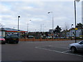
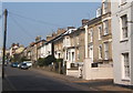
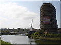
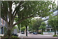
Photos of IP1 2AP


Area Information
Living in IP1 2AP means inhabiting a small, densely populated residential cluster in England, where 1,405 people reside across just 3,329 square metres. This compact area is characterised by its proximity to retail and rail infrastructure, with M&S Ipswich, Tesco, and Morrisons within practical reach. The community is predominantly composed of adults aged 30–64, reflecting a mature demographic with a median age of 47. Daily life here is shaped by the area’s limited size and high population density of 422,070 people per square kilometre, creating a tightly knit environment. While the area lacks natural landscapes or protected sites, its strategic location near rail hubs like Ipswich Railway Station offers easy access to regional connectivity. However, the small footprint means amenities are concentrated, requiring residents to navigate a balance between convenience and space. For those seeking a compact, urbanised setting with immediate access to shopping and transport, IP1 2AP offers a distinct, if densely packed, lifestyle.
- Area Type
- Postcode
- Area Size
- 3329 m²
- Population
- 1405
- Population Density
- 3604 people/km²
The property market in IP1 2AP is dominated by rental flats, with only 17% of residents owning their homes. This indicates a predominantly rental market, where property ownership is not the norm. The concentration of flats suggests a housing stock designed for smaller households or shared occupancy, possibly including purpose-built or converted buildings. Given the area’s small size and high population density, the housing stock is limited, meaning buyers must consider the broader surrounding area for options. The low home ownership rate may reflect affordability challenges or a preference for renting in a densely populated setting. For prospective buyers, this suggests a market where property values may be influenced by rental demand rather than owner-occupation. The compact nature of the area also means that property searches are likely to extend beyond IP1 2AP itself.
House Prices in IP1 2AP
No properties found in this postcode.
Energy Efficiency in IP1 2AP
Residents of IP1 2AP have access to a range of nearby amenities, including retail outlets such as M&S Ipswich, Tesco St., and Morrisons Daily, which provide everyday shopping convenience. The presence of five rail stations, including Ipswich Railway Station, ensures easy access to regional transport, supporting both work and leisure travel. While the area lacks detailed information on parks or leisure facilities, the concentration of retail and transport hubs suggests a lifestyle focused on practicality and connectivity. The compact nature of the area means that amenities are within walking distance, reducing the need for cars. This creates a sense of immediacy in daily life, where shopping, commuting, and socialising are all within a short radius. However, the absence of natural or recreational spaces may limit opportunities for outdoor activities, requiring residents to travel further for such pursuits.
Amenities
Schools
| Rank | School | Type | Entry gender | Ages |
|---|
Explore more schools in this area
Go to Schools tabDemographics
The population of IP1 2AP is predominantly adults aged 30–64, with a median age of 47. This suggests a community of established professionals and families, though the 17% home ownership rate indicates that most residents are renters rather than property owners. The accommodation type is primarily flats, reflecting a housing stock tailored to smaller households or shared living arrangements. The predominant ethnic group is White, with no data provided on other demographics. The area’s high population density of 422,070 people per square kilometre implies a compact, possibly overcrowded environment, which may impact quality of life. While the data does not specify deprivation levels, the low home ownership and high density suggest a reliance on rental markets and shared resources. This demographic profile paints a picture of a mature, stable community with limited scope for expansion or new housing developments.
Household Size
Accommodation Type
Tenure
Ethnic Group
Religion
Household Composition
Age
Household Deprivation
NS-SEC
Explore more demographic insights in this area
Go to Demographics tabPlanning
Planning Constraints
- Flood RiskPremium
- Ramsar Wetland SitesPremium
- Area of Outstanding Natural BeautyPremium
- Protected Nature ReservePremium
- Protected WoodlandPremium
- Crime RiskPremium