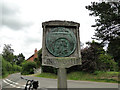
Area Overview for Ingworth
Photos of Ingworth

Area Information
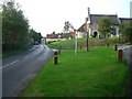
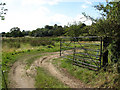
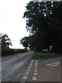
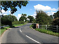
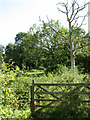
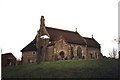
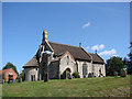
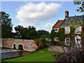
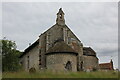
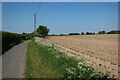
Ingworth is a compact civil parish covering just 2.1 square kilometres in England. You are stepping into a community defined by its small scale and established character. This area does not sprawl; instead, it offers a concentrated living environment where residents know their surroundings intimately. The distinctiveness of Ingworth lies in its quiet remoteness and its function as a rural settlement rather than a growth hub. When you consider living in Ingworth, expect a lifestyle that prioritises space and peace over urban conveniences. The demographic profile reveals a deeply rooted community. Nearly seventy-five percent of households own their homes, suggesting long-term residency and stability. There are no large commercial enterprises driving the local economy; the focus remains on residential life. You will find yourself in an area where daily life moves at a measured pace. The layout supports a low-density existence, making it ideal for those who value proximity to nature. While access to city centres requires a journey, the internal atmosphere of the parish remains consistent and familiar. Prospective buyers looking for homes in Ingworth should understand that this is a place for settlement, not transience. The area size limits the variety of property types but ensures that anything you find is well-maintained by owners who plan to stay. You will not find the noise or congestion associated with larger towns. Instead, you gain a neighbourhood where the boundaries are clear and the sense of ownership is pervasive. This consistency shapes the daily rhythm of every person who calls Ingworth home.
- Area Type
- Parish
- Area Size
- 2.1 km²
- Population
- Not available
- Population Density
- Not available
Demographics
The community within Ingworth presents a clear age profile that stands out from many other English parishes. The median age for residents is 70 years. This statistic indicates a population dominated by older adults who have chosen to remain in the area or have moved here for retirement. When you look at living in Ingworth, you are joining a demographic where life experience is the primary currency. The age range distribution confirms that the majority of inhabitants fall into the senior category, creating a settled neighbourhood rather than a dynamic hub of young professionals or families with school-age children. Home ownership rates further define the social fabric of the parish. Seven out of every ten residents own their property. This high percentage reflects a community invested in its long-term future. You will find few landlords managing rental portfolios here; instead, neighbours look after neighbours. The household composition aligns with this ownership model. Accommodation types across the parish mirror this stability, with a lack of transient housing. Ethnic and religious diversity data are not available for this specific parish. While you may encounter varied communities in broader regions, the data for Ingworth focuses on these demographic constants. This homogeneity contributes to a cohesive, tight-knit environment. You move here knowing exactly the type of neighbourly support system you will engage with. The population does not shift rapidly, and the social connections formed tend to be enduring.
Household Size
Accommodation Type
Tenure
Ethnic Group
Religion
Household Composition
Age
Household Deprivation
NS-SEC
Explore more demographic insights in this area
Go to Demographics tabPlanning
Planning Constraints
- Flood RiskPremium
- Ramsar Wetland SitesPremium
- Area of Outstanding Natural BeautyPremium
- Protected Nature ReservePremium
- Protected WoodlandPremium
- Crime RiskPremium