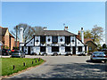
Area Overview for Ingrave and Herongate
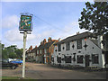
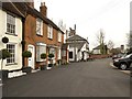
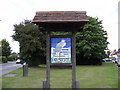
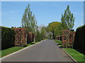
Photos of Ingrave and Herongate


Area Information
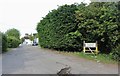
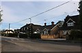
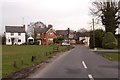
Ingrave and Herongate stands as a built-up area comprising roughly 75.7 hectares within the wider context of the Essex countryside. This neighbourhood represents a distinct community where daily life is shaped by its established character and proximity to key transport links. Residents here benefit from a setting that balances rural quiet with practical access to larger towns. The area functions effectively as a residential hub for those seeking a settled home life without the intense energy of a major city centre. Living in Ingrave and Herongate means being part of a defined locality with clear boundaries and a sense of place that dates back generations. You will find a layout typical of older settlements where houses often sit close together, fostering a local awareness among neighbours. The scale of the area ensures that everything from local shops to key transport gateways remains within a manageable drive or walk, depending on specific streets. Homes in this district cater to people who value a permanent address rather than transient living. The environment provides a foundation for a stable household setup, supported by nearby infrastructure that has served the region for decades. This location offers a straightforward residential experience where the focus remains on home ownership and community stability.
- Area Type
- Built Up Area 250
- Area Size
- 75.7 hectares
- Population
- Not available
- Population Density
- Not available
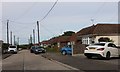
Daily life in Ingrave and Herongate revolves around practical accessibility to essential services and retail outlets. Within easy reach, you have access to five retail locations, including the M&S Ingrave BP, Morrisons Daily West, and Tesco Brentwood. These venues ensure that groceries and everyday shopping needs are met without long journeys into Brentwood or beyond. For commuting, five railway stations lie nearby, providing convenient access to West Horndon, Brentwood, and Shenfield Railway Stations. Residents can catch trains from these hubs to reach Upminster Bridge or further connections to London. The network of locomotive stations offers flexibility, allowing you to choose different lines or times depending on your destination. If you prefer driving, the proximity to these hubs also serves as a geographic advantage for accessing the wider road network. Your lifestyle will be defined by this blend of local convenience and regional connectivity. You can enjoy the peace of a village setting while maintaining the ability to shop at major supermarkets or travel to city centres quickly. The presence of these specific amenities like the Tesco and Morrisons ensures that household routines remain uninterrupted and efficient.
Amenities
Schools
For families considering a move to this area, the primary education options are limited to a single specific provision. The notable school in Ingrave and Herongate is the Ingrave Johnstone Church of England Voluntary Aided Primary School. This institution holds an Ofsted rating of good, ensuring a standard of education that meets the national framework for quality provision. It is a primary school, meaning it covers the early years of compulsory education until children reach adolescence. You will not find secondary schools listed within the immediate data scope, suggesting families often rely on catchment areas in larger towns for older children or consider boarding schools. The presence of one primary school indicates that the local neighbourhood serves specific younger demographics or draws pupils from a wider radius to fill its roll. The voluntary aided status implies support from the Church of England alongside local council funding. Choosing children's education here means travelling to this single local option for primary years before transitioning to external secondary institutions. The good rating provides a reassuring baseline for the early schooling experience in this built-up area.
| Rank | School | Type | Entry gender | Ages |
|---|
Explore more schools in this area
Go to Schools tabDemographics
The community profile of Ingrave and Herongate reflects a mature population with a median age of 70 years. You will encounter a neighbourhood where the dominant age group is significantly older than the national average. This demographic reality shapes the local culture, with fewer young families moving in compared to areas with a younger workforce. Data indicates that 85% of households occupy their property outright. This high ownership rate signals that most residents are settled in their homes for the long term. Consequently, the housing stock consists largely of owner-occupied properties rather than privately rented units. The area hosts a diverse range of ages under the broad "Total" category but distinctly skews towards retirement or older adulthood. You are unlikely to find a transient population living here. The accommodation types suit older preferences, likely featuring detached or semi-detached bungalows and larger houses common in such built-up zones. The ethnic composition and religious breakdown are recorded in the total household data, reflecting the specific local makeup without imposing external diversity statistics. Living here offers a stable environment where long-term residents form the core of the social fabric.
Household Size
Accommodation Type
Tenure
Ethnic Group
Religion
Household Composition
Age
Household Deprivation
NS-SEC
Explore more demographic insights in this area
Go to Demographics tabPlanning
Planning Constraints
- Crime RiskPremium