Area Overview for Ingatestone, Fryerning & Mountnessing Ward
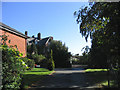
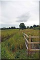
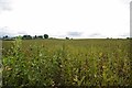
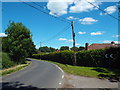
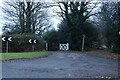
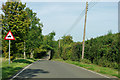
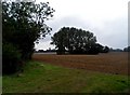
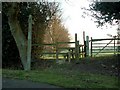
Photos of Ingatestone, Fryerning & Mountnessing Ward
Area Information
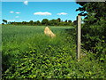
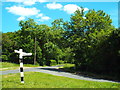
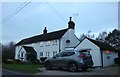
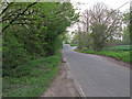
Living in Ingatestone, Fryerning & Mountnessing Ward offers a distinctly rural experience within the Borough of Brentwood. This electoral ward covers an area of 27.9 km² and is home to approximately 1,285 residents. The location defines its boundaries through historic Saxon and Norman territories along the ancient Essex Great Road. You are situated within a parish that encompasses three distinct villages: Ingatestone, the larger settlement with local amenities; Fryerning, which lies two miles north and remains largely unchanged; and Mountnessing. Daily life here revolves around a quiet, countryside setting characterised by picturesque woodlands and public footpaths. The ward sits near the A12 motorway yet maintains the feel of historic settlements formed from fragmented medieval lands. Ingatestone features a High Street with shops, pubs, and restaurants, while Fryerning retains a more secluded village atmosphere. The area boasts significant historical depth, from Ice Age Sarsen Stones to a surviving 13th-century barn at North Hall Farm. If you seek a home based in an environment where speed limits please you and ancient farmhouses still stand, this ward delivers. The village feels timeless, defined by the absence of modern sprawl and the presence of conservation areas protecting listed buildings.
- Area Type
- District Borough Unitary Ward
- Area Size
- 27.9 km²
- Population
- 1285
- Population Density
- 46 people/km²
Demographics
The community in Ingatestone, Fryerning & Mountnessing Ward presents a mature and established population profile. You will find that the median age in this area is 70 years. This demographic skew indicates a retirement-focused neighbourhood where long-term residents have settled for decades. Currently, 73% of residents are homeowners, a figure that demonstrates a strong attachment to the land and a reduction in transient renting populations. The remaining households reflect a mix of rental or shared living arrangements typical of rural English villages, though specific breakdowns of household composition are not detailed in the available records. Ownership levels in Ingatestone, Fryerning & Mountnessing Ward contribute to community stability and lower turnover rates. The population density stands at 46 people per km², ensuring sufficient space between properties while maintaining village cohesion. Ethnic diversity and religious demographics are not quantified in the current data, but the history of Fryerning Abbey, linked to Wadham College, suggests a traditional social fabric. You move here for stability, knowing that neighbours are likely to stay for years. This age profile means you may engage with a community where decades-old traditions persist alongside modern rural living.
Household Size
Accommodation Type
Tenure
Ethnic Group
Religion
Household Composition
Age
Household Deprivation
NS-SEC
Explore more demographic insights in this area
Go to Demographics tabPlanning
Planning Constraints
- Flood RiskPremium
- Ramsar Wetland SitesPremium
- Area of Outstanding Natural BeautyPremium
- Protected Nature ReservePremium
- Protected WoodlandPremium
- Crime RiskPremium