Area Overview for IG9 5DZ
Photos of IG9 5DZ
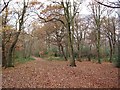
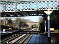
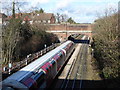
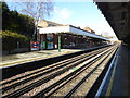
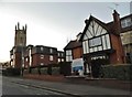
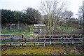

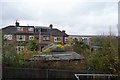
40 photos from this area
Area Information
Key information about the IG9 5DZ including its size, population, and administrative classification.
- Area Type
- Postcode
- Area Size
- 1.7 hectares
- Population
- 1762
- Population Density
- 2842 people/km²
House Prices in IG9 5DZ
55
Properties
£485,548
Average Sold Price
£95,000
Lowest Price
£1,350,000
Highest Price
Showing 55 properties
| Address | Type | Beds | Baths | Last Sale Price | Last Sale Date | |
|---|---|---|---|---|---|---|
| 79 Princes Road, Buckhurst Hill, IG9 5DZ | Terraced | 3 | 2 | £825,000 | Mar 2025 | |
| 76 Princes Road, Buckhurst Hill, IG9 5DZ | Semi-detached | 3 | 2 | £895,000 | Mar 2025 | |
| 67 Princes Road, Buckhurst Hill, IG9 5DZ | Terraced | 3 | 1 | £590,000 | Jan 2025 | |
| 59 Princes Road, Buckhurst Hill, IG9 5DZ | Terraced | 4 | 2 | £825,000 | Mar 2024 | |
| 68 Princes Road, Buckhurst Hill, IG9 5DZ | Semi-detached | 3 | 1 | £500,000 | Aug 2022 | |
| 85 Princes Road, Buckhurst Hill, IG9 5DZ | Terraced | 3 | 1 | £920,000 | Aug 2022 | |
| 97 Princes Road, Buckhurst Hill, IG9 5DZ | Semi-detached | 3 | 2 | £665,000 | Jul 2022 | |
| 56 Princes Road, Buckhurst Hill, IG9 5DZ | Semi-detached | 4 | 2 | £560,000 | Feb 2022 | |
| 55 Princes Road, Buckhurst Hill, IG9 5DZ | Terraced | 3 | 2 | £600,000 | Jun 2021 | |
| 61 Princes Road, Buckhurst Hill, IG9 5DZ | Detached | 3 | 1 | £655,000 | Feb 2021 |
Page 1 of 6
Energy Efficiency in IG9 5DZ
Amenities
Schools
| Rank | School | Type | Entry gender | Ages |
|---|
Explore more schools in this area
Go to Schools tabDemographics
Household Size
Family (3-5 people)
most common
Accommodation Type
Houses
most common
Tenure
70
majority
Ethnic Group
White
most common
Religion
N/A
most common
Household Composition
N/A
most common
Age
47
median
Adults (30-64 years)
most common
Household Deprivation
N/A
with no deprivation
NS-SEC
51
in Lower managerial occupations
Explore more demographic insights in this area
Go to Demographics tabPlanning
Planning Constraints
- Flood RiskPremium
- Ramsar Wetland SitesPremium
- Area of Outstanding Natural BeautyPremium
- Protected Nature ReservePremium
- Protected WoodlandPremium