Area Overview for IG9 5AN
Photos of IG9 5AN


Area Information
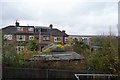
Living in IG9 5AN offers a quiet, residential lifestyle in a small cluster of homes that cater to a mature demographic. With a population of 1,678, the area feels close-knit, where daily life is shaped by proximity to essential services and transport links. The postcode sits in a part of England where the housing stock is predominantly family homes, reflecting the community’s focus on stability. Residents benefit from nearby schools, retail outlets, and public transport, making it practical for both commuters and those who prefer a slower pace. The area’s compact size means amenities are within walking or short driving distance, fostering a sense of accessibility. While it lacks the density of larger urban centres, IG9 5AN provides a balance between suburban comfort and connectivity to nearby towns. For those seeking a place with low crime rates and minimal environmental constraints, this postcode offers a straightforward, no-frills living experience. Its appeal lies in simplicity: reliable infrastructure, a mature population, and a lack of planning restrictions that might complicate development.
- Area Type
- Postcode
- Area Size
- Not available
- Population
- 1678
- Population Density
- 3142 people/km²
The property market in IG9 5AN is characterised by a strong emphasis on owner-occupied homes, with 75% of residents living in properties they own. This contrasts with areas where rental demand drives the market, suggesting a more stable, long-term buyer base. The predominant accommodation type is houses, which aligns with the area’s suburban character and the presence of family-focused households. Given the small size of the postcode, the housing stock is likely limited, meaning buyers may need to consider nearby areas for more options. The high home ownership rate also indicates that properties here are often held by residents for extended periods, reducing turnover. For prospective buyers, this suggests a market where properties are likely to be in good condition, with potential for long-term value retention. However, the limited number of homes within the postcode itself means competition could be fierce, requiring buyers to look beyond the immediate area for additional choices.
House Prices in IG9 5AN
No properties found in this postcode.
Energy Efficiency in IG9 5AN
The lifestyle in IG9 5AN is shaped by its proximity to a range of amenities, from retail to transport. Local shops such as Waitrose Buckhurst and Sainsburys Woodford Green cater to daily needs, while the nearby Cook Woodford adds to the variety of dining and shopping options. The area’s transport network is robust, with multiple metro, rail, and bus services, including Buckhurst Hill Underground Station and Chingford Station, which connect residents to London and beyond. For leisure, the lack of detailed data on parks or recreational spaces means the focus is on practicality—amenities are chosen for their utility rather than their scenic value. The presence of a bus interchange at Whipps Cross ensures flexibility for travel, while the retail options provide convenience. Overall, the area offers a functional lifestyle where accessibility to services and transport is prioritised over expansive leisure facilities.
Amenities
Schools
The nearest school to IG9 5AN is Daiglen School, an independent institution. This type of school typically offers fee-based education, often with smaller class sizes and specialised facilities compared to state schools. While no Ofsted rating is provided, independent schools are generally sought after by families prioritising specific educational approaches or resources. The presence of a single independent school in the area may indicate a niche demand for private education, though it leaves no state school options within the immediate vicinity. Families requiring state-funded schooling may need to look further afield, which could be a consideration for buyers prioritising school proximity. The lack of multiple schools also means the area’s educational landscape is not as diverse as larger towns, potentially limiting choices for parents with varying preferences.
| Rank | School | Type | Entry gender | Ages |
|---|
Explore more schools in this area
Go to Schools tabDemographics
The community in IG9 5AN is predominantly composed of adults aged 30–64, with a median age of 47. This suggests a stable population with established careers and families, reflected in the 75% home ownership rate. The area’s accommodation is largely houses, indicating a preference for single-family living over flats or apartments. The predominant ethnic group is White, with no specific data on diversity beyond this. The absence of detailed information on deprivation or household composition means the community’s socioeconomic profile remains broadly defined. However, the high home ownership rate and mature age range imply a population that values long-term investment in property. For buyers, this demographic profile suggests a market with fewer rental properties and a focus on owner-occupied homes. The age group also hints at a demand for well-maintained properties, as older residents may be looking to downsize or remain in familiar surroundings.
Household Size
Accommodation Type
Tenure
Ethnic Group
Religion
Household Composition
Age
Household Deprivation
NS-SEC
Explore more demographic insights in this area
Go to Demographics tabPlanning
Planning Constraints
- Flood RiskPremium
- Ramsar Wetland SitesPremium
- Area of Outstanding Natural BeautyPremium
- Protected Nature ReservePremium
- Protected WoodlandPremium