Area Overview for IG10 4PP
Photos of IG10 4PP
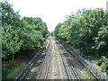
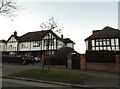
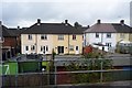
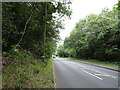
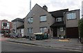
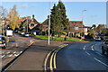
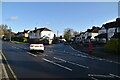
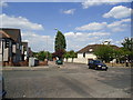

36 photos from this area
Area Information
Key information about the IG10 4PP including its size, population, and administrative classification.
- Area Type
- Postcode
- Area Size
- 3.4 hectares
- Population
- 1665
- Population Density
- 2280 people/km²
House Prices in IG10 4PP
19
Properties
£452,884
Average Sold Price
£165,000
Lowest Price
£870,000
Highest Price
Showing 19 properties
| Address | Type | Beds | Baths | Last Sale Price | Last Sale Date | |
|---|---|---|---|---|---|---|
| 12 Regents Place, Loughton, IG10 4PP | Semi-detached | 3 | 2 | £645,000 | Jan 2025 | |
| 7 Regents Place, Loughton, IG10 4PP | Terraced | 3 | 2 | £675,050 | Nov 2022 | |
| 10 Regents Place, Loughton, IG10 4PP | Semi-detached | 5 | 2 | £750,000 | Jun 2021 | |
| 4 Regents Place, Loughton, IG10 4PP | Terraced | 3 | 2 | £625,000 | Jan 2021 | |
| 18 Regents Place, Loughton, IG10 4PP | Terraced | 4 | 3 | £487,750 | Oct 2018 | |
| 5 Regents Place, Loughton, IG10 4PP | Terraced | 3 | 2 | £870,000 | Nov 2017 | |
| 11 Regents Place, Loughton, IG10 4PP | house | 3 | - | £550,000 | Aug 2016 | |
| 17 Regents Place, Loughton, IG10 4PP | Terraced | 4 | 3 | £495,000 | Sep 2015 | |
| 3 Regents Place, Loughton, IG10 4PP | Terraced | 3 | 2 | £615,000 | Dec 2014 | |
| 13 Regents Place, Loughton, IG10 4PP | Semi-detached | 3 | 2 | £432,000 | Dec 2014 |
Page 1 of 2
Energy Efficiency in IG10 4PP
Amenities
Schools
| Rank | School | Type | Entry gender | Ages |
|---|
Explore more schools in this area
Go to Schools tabDemographics
Household Size
Family (3-5 people)
most common
Accommodation Type
Houses
most common
Tenure
85
majority
Ethnic Group
White
most common
Religion
N/A
most common
Household Composition
N/A
most common
Age
47
median
Adults (30-64 years)
most common
Household Deprivation
N/A
with no deprivation
NS-SEC
52
in Lower managerial occupations
Explore more demographic insights in this area
Go to Demographics tabPlanning
Planning Constraints
- Flood RiskPremium
- Ramsar Wetland SitesPremium
- Area of Outstanding Natural BeautyPremium
- Protected Nature ReservePremium
- Protected WoodlandPremium