Area Overview for IG10 4HX
Photos of IG10 4HX
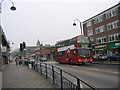

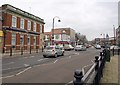
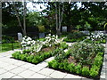


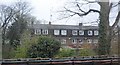
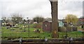

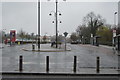

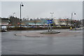
65 photos from this area
Area Information
Key information about the IG10 4HX including its size, population, and administrative classification.
- Area Type
- Postcode
- Area Size
- 1.9 hectares
- Population
- 1540
- Population Density
- 1448 people/km²
House Prices in IG10 4HX
42
Properties
£444,390
Average Sold Price
£64,000
Lowest Price
£1,080,000
Highest Price
Showing 42 properties
| Address | Type | Beds | Baths | Last Sale Price | Last Sale Date | |
|---|---|---|---|---|---|---|
| 48 Meadow Road, Loughton, IG10 4HX | Terraced | 3 | 2 | £765,000 | Oct 2025 | |
| 26 Meadow Road, Loughton, IG10 4HX | house | 4 | 2 | £656,000 | Oct 2024 | |
| 24 Meadow Road, Loughton, IG10 4HX | Semi-detached | 3 | 3 | £780,000 | Sep 2024 | |
| 6A Meadow Road, Loughton, IG10 4HX | Maisonette | 2 | 1 | £369,000 | Mar 2024 | |
| 68 Meadow Road, Loughton, IG10 4HX | Semi-detached | 4 | 2 | £1,080,000 | Jul 2023 | |
| 30 Meadow Road, Loughton, IG10 4HX | Terraced | 2 | 1 | £560,000 | Sep 2021 | |
| 10A Meadow Road, Loughton, IG10 4HX | Maisonette | 2 | - | £380,000 | Mar 2021 | |
| 10 Meadow Road, Loughton, IG10 4HX | Detached | 3 | 1 | £370,000 | Jan 2021 | |
| Choumert Cottage, 50 Meadow Road, Loughton, IG10 4HX | Terraced | 3 | 2 | £690,000 | Nov 2020 | |
| 78A Meadow Road, Loughton, IG10 4HX | Flat | - | - | £472,500 | Apr 2020 |
Page 1 of 5
Energy Efficiency in IG10 4HX
Amenities
Schools
| Rank | School | Type | Entry gender | Ages |
|---|
Explore more schools in this area
Go to Schools tabDemographics
Household Size
Family (3-5 people)
most common
Accommodation Type
Houses
most common
Tenure
82
majority
Ethnic Group
White
most common
Religion
N/A
most common
Household Composition
N/A
most common
Age
47
median
Adults (30-64 years)
most common
Household Deprivation
N/A
with no deprivation
NS-SEC
55
in Lower managerial occupations
Explore more demographic insights in this area
Go to Demographics tabPlanning
Planning Constraints
- Flood RiskPremium
- Ramsar Wetland SitesPremium
- Area of Outstanding Natural BeautyPremium
- Protected Nature ReservePremium
- Protected WoodlandPremium