Area Overview for IG10 4AB
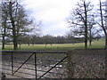
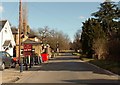
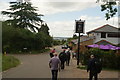
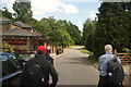
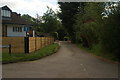
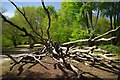
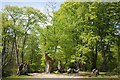
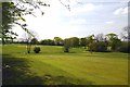
Photos of IG10 4AB

Area Information
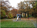
Living in IG10 4AB offers a compact, residential experience shaped by its modest size and established community. Covering 16.6 hectares, this postcode area is home to 2,774 residents, creating a close-knit environment where daily life is defined by local routines and familiar faces. The population density of 124 people per square kilometre suggests a balance between private space and communal interaction. This area is characterised by its mix of homes, predominantly owner-occupied, which reflects a stable, long-term resident base. The proximity to schools, transport hubs, and retail outlets ensures convenience without the congestion of larger urban centres. For those seeking a quiet yet connected lifestyle, IG10 4AB provides access to essential services while maintaining a distinct local identity. Its small footprint means residents are likely to know their neighbours, with a focus on practical living over sprawling development. The area’s appeal lies in its simplicity: a place where family life, routine, and community coexist without pretension.
- Area Type
- Postcode
- Area Size
- 16.6 hectares
- Population
- 2774
- Population Density
- 124 people/km²
The property market in IG10 4AB is dominated by owner-occupied homes, with 81% of residents living in properties they own. This high rate of home ownership indicates a stable, long-term resident base and suggests that the area is less reliant on rental housing. The accommodation type is predominantly houses, which aligns with the postcode’s residential character and lower population density. For buyers considering this small area, the focus is on individual properties rather than larger developments, meaning the market is likely to be niche and competitive. The limited size of the area means that housing stock is constrained, and buyers may need to look beyond the immediate postcode for more options. The presence of houses also implies a preference for private, family-oriented living, which may appeal to those seeking space and a quieter environment. However, the small footprint of the area means that property availability is limited, and buyers should approach the market with realistic expectations.
House Prices in IG10 4AB
Showing 7 properties
| Address | Type | Beds | Baths | Last Sale Price | Last Sale Date | |
|---|---|---|---|---|---|---|
| Pack Saddles, Avey Lane, Waltham Abbey, IG10 4AB | Retail | 6 | 5 | £3,600,000 | Sep 2022 | |
| Wish Cottage, Avey Lane, Waltham Abbey, IG10 4AB | house | - | - | £2,300,000 | Jun 2019 | |
| 2, Manor House, Avey Lane, Waltham Abbey, IG10 4AB | Terraced | 2 | - | - | - | |
| Stable Lodge, Manor House, Avey Lane, Waltham Abbey, IG10 4AB | Detached | - | - | - | - | |
| High Beech Village Hall, Avey Lane, Waltham Abbey, IG10 4AB | commercial | - | - | - | - | |
| Tennis 84M From Packsaddles, Avey Lane 125M From Avey Lane, Avey Lane, Waltham Abbey, IG10 4AB | Leisure | - | - | - | - | |
| 3, Manor House, Avey Lane, Waltham Abbey, IG10 4AB | Terraced | - | - | - | - |
Energy Efficiency in IG10 4AB
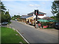
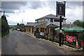
The lifestyle in IG10 4AB is shaped by its proximity to retail, transport, and community hubs. Nearby amenities include Morrisons Loughton, Cook Loughton, and Co-op Upshire, providing essential shopping and grocery needs within practical reach. The area’s transport network, including multiple Underground and rail stations, ensures easy access to larger urban centres, while the Whipps Cross Bus Interchange connects residents to broader regional routes. Although the data does not specify parks or leisure facilities, the presence of schools and retail options suggests a focus on practical living. The compact nature of the area means that daily errands and social interactions can be managed without long commutes, fostering a self-contained community. Residents benefit from a balance between local convenience and the ability to travel further afield, supporting both independent living and integration with surrounding areas.
Amenities
Schools
Residents of IG10 4AB have access to a range of educational institutions, including both state and independent schools. High Beech Church of England Voluntary Controlled Primary School and High Beech CofE Primary School are state-funded options, with the latter holding an Ofsted rating of ‘good’. Sewardstone College of Education is an independent school, offering an alternative to the state system. The mix of school types provides families with flexibility, whether they prioritise public education or seek the structure of an independent institution. The presence of a ‘good’-rated primary school suggests that local education meets acceptable standards, though parents may need to consider travel times for secondary education, as no secondary schools are listed in the data. The diversity of options supports different educational philosophies and financial circumstances, ensuring that families can choose a setting that aligns with their priorities.
| Rank | School | Type | Entry gender | Ages |
|---|
Explore more schools in this area
Go to Schools tabDemographics
The demographic profile of IG10 4AB is defined by a median age of 47, with the majority of residents falling within the 30-64 age range. This suggests a mature, established population, likely with strong ties to local institutions and a focus on long-term stability. Home ownership is high, at 81%, indicating a community of property owners rather than renters, which can contribute to a sense of permanence. The predominant accommodation type is houses, aligning with the area’s residential character and lower population density. The ethnic composition is largely White, with no specific data on minority representation, though this does not necessarily imply a lack of diversity. The age profile and home ownership figures suggest a low-deprivation environment, where residents may prioritise security, family-oriented living, and proximity to services. This demographic structure supports a lifestyle centred on community, with fewer transient populations compared to areas with higher rental rates or younger demographics.
Household Size
Accommodation Type
Tenure
Ethnic Group
Religion
Household Composition
Age
Household Deprivation
NS-SEC
Explore more demographic insights in this area
Go to Demographics tabPlanning
Planning Constraints
- Flood RiskPremium
- Ramsar Wetland SitesPremium
- Area of Outstanding Natural BeautyPremium
- Protected Nature ReservePremium
- Protected WoodlandPremium