Area Overview for IG10 3TR
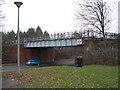
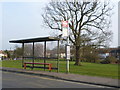
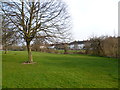
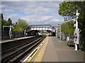
Photos of IG10 3TR
Area Information
Living in IG10 3TR means inhabiting a compact, densely populated residential cluster in England. The area covers just 7.3 hectares, housing 1,758 people in a population density of 23,951 per square kilometre. This small postcode area is characterised by a mature demographic, with a median age of 47 and the majority of residents falling within the 30–64 age range. Daily life here is defined by proximity to amenities, with shops, transport hubs, and schools within easy reach. The area’s small size means a tight-knit community feel, though the high population density can create a sense of congestion. While the housing stock is predominantly flats, the area’s appeal lies in its accessibility to major transport routes, including underground stations and rail links. For those seeking a quiet residential spot with urban connectivity, IG10 3TR offers a blend of practicality and convenience, though its limitations in space and home ownership rates reflect its role as a rental-heavy, commuter-focused enclave.
- Area Type
- Postcode
- Area Size
- 7.3 hectares
- Population
- 1758
- Population Density
- 2913 people/km²
The property market in IG10 3TR is dominated by flats, with home ownership at just 35%. This indicates that the area functions more as a rental market than an owner-occupied one, likely catering to commuters and those seeking affordable housing in a well-connected location. The high population density and small area size mean that housing stock is limited, with little scope for expansion or new developments. For buyers, this presents challenges: the scarcity of available properties, combined with the dominance of rental units, may make purchasing a home here difficult. The area’s compactness also means that properties are likely to be smaller, with limited outdoor space. However, its proximity to transport links and amenities could offset these drawbacks for those prioritising convenience over property size. Potential buyers should consider the long-term viability of owning in a market where demand may outstrip supply, particularly given the area’s role as a commuter hub.
House Prices in IG10 3TR
Showing 2 properties
| Address | Type | Beds | Baths | Last Sale Price | Last Sale Date | |
|---|---|---|---|---|---|---|
| Land Bet M11 And Comm Premises East Of Langston Road, Langston Road, Loughton, IG10 3TR | warehouse | - | - | - | - | |
| Phoenix Aromas Europe Ltd, Unit 11 And 12, Prospect Business Park, Langston Road, Loughton, IG10 3TR | Industrial | - | - | - | - |
Energy Efficiency in IG10 3TR
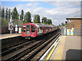
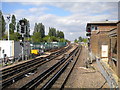
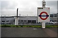
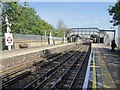
Life in IG10 3TR is shaped by its proximity to a range of amenities, from retail outlets to transport hubs. The area is within walking distance of five retail locations, including Aldi Debden, Iceland Debden, and Sainsburys Debden, ensuring easy access to groceries and everyday shopping. Multiple metro and rail stations, such as Debden Underground and Chingford Station, provide seamless connections to London and nearby towns. The Whipps Cross Bus Interchange offers additional transport flexibility, while North Weald Airport caters to those requiring air travel. These facilities contribute to a lifestyle that balances convenience with urban accessibility. However, the compact nature of the area means that recreational spaces are limited, and the high population density could reduce the availability of green areas. The mix of retail, transport, and travel options makes IG10 3TR practical for those prioritising efficiency, though the lack of expansive parks or leisure facilities may be a drawback for those seeking more open spaces.
Amenities
Schools
The nearest school to IG10 3TR is Epping Forest High School, a primary institution. While no secondary schools are listed in the data, the presence of a primary school is a key consideration for families with young children. The school’s role in the local community is likely significant, providing a focal point for family life and social interaction. However, the absence of secondary education options within the immediate area may require families to travel to nearby towns for secondary schooling. This could impact the area’s appeal for households with older children, though the proximity to transport links may mitigate travel times. The single listed school suggests that the educational landscape is limited, and prospective residents should investigate additional options beyond the immediate postcode. For those prioritising ease of access to schooling, the availability of a primary school is a positive, but the lack of comprehensive educational infrastructure may be a drawback.
| Rank | School | Type | Entry gender | Ages |
|---|
Explore more schools in this area
Go to Schools tabDemographics
The community in IG10 3TR is predominantly composed of adults aged 30–64, with a median age of 47. This suggests a population skewed towards middle-aged individuals, likely including professionals and families. Home ownership is relatively low at 35%, indicating that the majority of residents rent their accommodation. The primary housing type is flats, reflecting the area’s compact nature and high density. The predominant ethnic group is White, though specific data on diversity is not provided. The population density of 23,951 per square kilometre is exceptionally high, which may influence the character of daily life, with limited private outdoor space and a focus on shared communal areas. This density also means that amenities are closely clustered, reducing travel time for essential services. However, it may contribute to a sense of overcrowding or reduced privacy for residents. The demographic profile suggests a stable, established community, though the lack of younger residents could affect the vibrancy of local social hubs.
Household Size
Accommodation Type
Tenure
Ethnic Group
Religion
Household Composition
Age
Household Deprivation
NS-SEC
Explore more demographic insights in this area
Go to Demographics tabPlanning
Planning Constraints
- Flood RiskPremium
- Ramsar Wetland SitesPremium
- Area of Outstanding Natural BeautyPremium
- Protected Nature ReservePremium
- Protected WoodlandPremium