Area Overview for IG10 3SS
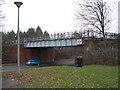
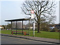
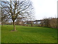
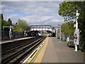
Photos of IG10 3SS


Area Information
Living in IG10 3SS means inhabiting a compact, high-density residential cluster in England. The area covers just 4,317 m², yet it is home to 1,758 residents, resulting in a population density of 407,195 people per km². This suggests a tightly packed community where proximity to amenities and services is a defining feature. The area is predominantly inhabited by adults aged 30–64, with a median age of 47, indicating a mature, stable population. Daily life here is likely shaped by the need for efficient urban living, with a focus on accessible transport and nearby retail. While the data does not provide details on local culture or social activities, the presence of multiple transport hubs and shops suggests a practical, convenience-driven lifestyle. For homebuyers, this area offers a small, densely populated environment with strong connectivity, though the high density may influence the character of the neighbourhood.
- Area Type
- Postcode
- Area Size
- 4317 m²
- Population
- 1758
- Population Density
- 2913 people/km²
The property market in IG10 3SS is characterised by a high proportion of rental properties, with only 35% of residents owning their homes. The accommodation type is predominantly flats, which aligns with the area’s high population density and compact size. This suggests a housing stock that prioritises space efficiency over larger, detached properties. For buyers, this means the area is unlikely to offer traditional family homes or larger plots, with flats being the primary option. The small size of the area and its focus on flats may also indicate limited scope for property development, making available homes potentially scarce. Buyers should consider the implications of a rental-heavy market, including potential competition for flats and the need to assess long-term viability in a densely populated environment. The lack of data on property prices or recent sales trends means further local research would be necessary for a comprehensive market analysis.
House Prices in IG10 3SS
Showing 14 properties
| Address | Type | Beds | Baths | Last Sale Price | Last Sale Date | |
|---|---|---|---|---|---|---|
| 170 The Broadway, Loughton, IG10 3SS | Terraced | 3 | 2 | £490,000 | Mar 2024 | |
| 180 The Broadway, Loughton, IG10 3SS | house | - | - | £600,000 | Dec 2022 | |
| 172 The Broadway, Loughton, IG10 3SS | house | - | - | £460,000 | Aug 2022 | |
| 182 The Broadway, Loughton, IG10 3SS | Terraced | 3 | 1 | £405,000 | Jul 2016 | |
| 166 The Broadway, Loughton, IG10 3SS | Terraced | 3 | 1 | £227,500 | Sep 2013 | |
| 174 The Broadway, Loughton, IG10 3SS | house | - | - | £245,000 | Sep 2011 | |
| 178 The Broadway, Loughton, IG10 3SS | Terraced | - | - | £62,000 | Jan 1997 | |
| 184 The Broadway, Loughton, IG10 3SS | Terraced | 3 | 1 | - | - | |
| 188 The Broadway, Loughton, IG10 3SS | Retail | 3 | 2 | - | - | |
| 164 The Broadway, Loughton, IG10 3SS | Terraced | 3 | 1 | - | - |
Energy Efficiency in IG10 3SS
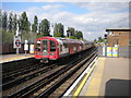
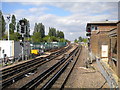
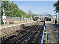
Residents of IG10 3SS have access to a range of amenities within practical reach, including five retail outlets such as Iceland Debden, Sainsburys Debden, and M&S Chigwell BP. These shops cater to everyday needs, from groceries to household items. The area’s transport links also provide access to leisure and travel opportunities, with North Weald Airport nearby and multiple rail and underground stations facilitating travel to London and beyond. While the data does not specify parks or recreational facilities, the presence of multiple transport hubs and retail options suggests a lifestyle focused on convenience and connectivity. The high density of the area may limit private outdoor space, but the proximity to shops, transport, and airports ensures a dynamic, urban-oriented lifestyle. For those prioritising accessibility over expansive green spaces, this area offers a practical, well-connected environment.
Amenities
Schools
The nearest school to IG10 3SS is Epping Forest High School, a primary institution. No data is provided on its Ofsted rating or academic performance, so prospective families must seek additional information to evaluate its quality. The presence of a primary school suggests the area is suitable for young children, though the absence of secondary schools or other educational facilities may require families to travel to nearby towns for higher education. The single listed school indicates a limited range of educational options, which could be a consideration for those prioritising a variety of school types. For families relying on local schools, the availability of a primary institution is a practical advantage, but further research into its resources and outcomes is advisable.
| Rank | School | Type | Entry gender | Ages |
|---|
Explore more schools in this area
Go to Schools tabDemographics
The community in IG10 3SS is predominantly composed of adults aged 30–64, with a median age of 47. Only 35% of residents own their homes, meaning the majority live in rented accommodation. The accommodation type is primarily flats, reflecting the area’s high population density. The predominant ethnic group is White, though no data is provided on other groups. The population density of 407,195 per km² is exceptionally high, suggesting a compact, possibly urban layout with limited open space. This density may influence the availability of private outdoor areas, though it ensures proximity to essential services. The age profile indicates a mature population, which may affect local amenities and social dynamics. For prospective buyers, understanding the rental-dominated market and flat-based housing stock is crucial, as it shapes both property availability and lifestyle expectations.
Household Size
Accommodation Type
Tenure
Ethnic Group
Religion
Household Composition
Age
Household Deprivation
NS-SEC
Explore more demographic insights in this area
Go to Demographics tabPlanning
Planning Constraints
- Flood RiskPremium
- Ramsar Wetland SitesPremium
- Area of Outstanding Natural BeautyPremium
- Protected Nature ReservePremium
- Protected WoodlandPremium