Area Overview for IG10 3RT
Photos of IG10 3RT


Area Information
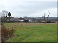
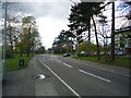
Living in IG10 3RT means being part of a compact, densely populated residential cluster in England. The area covers just 1,928 square metres, yet it houses 1,558 people, resulting in a population density of 807,989 per square kilometre. This high density reflects a tightly knit community, where daily life is shaped by proximity to essential services and transport links. The postcode is primarily residential, with homes outnumbering other property types. Its location offers a balance of urban convenience and suburban calm, with nearby amenities and transport hubs within easy reach. For those seeking a place with a strong sense of community, IG10 3RT’s mix of established residents and practical infrastructure makes it a compelling choice. The area’s small size means it is likely to feel familiar and cohesive, though buyers should consider its limited scope for expansion. Its appeal lies in its accessibility, with major roads and public transport options nearby, supporting both commuter lifestyles and those preferring a quieter, localised existence.
- Area Type
- Postcode
- Area Size
- 1928 m²
- Population
- 1558
- Population Density
- 5938 people/km²
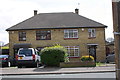
The property market in IG10 3RT is characterised by a 60% home ownership rate, with houses making up the majority of accommodation types. This suggests a market skewed towards owner-occupied homes rather than rental properties, which may indicate a preference for long-term stability among residents. The small area size and high population density imply a limited number of properties, potentially leading to competition for available homes. Buyers should consider the surrounding areas for broader options, as the immediate vicinity may have constrained availability. The predominance of houses over flats or apartments suggests a focus on family-friendly or more spacious living, which could appeal to those seeking traditional housing. However, the lack of data on property prices or recent sales trends means buyers must rely on local agents for up-to-date market insights.
House Prices in IG10 3RT
Showing 5 properties
| Address | Type | Beds | Baths | Last Sale Price | Last Sale Date | |
|---|---|---|---|---|---|---|
| 1 Ladyfields, Loughton, IG10 3RT | Terraced | 3 | 1 | £490,000 | Jun 2019 | |
| 3 Ladyfields, Loughton, IG10 3RT | Terraced | 2 | 1 | £370,000 | Nov 2018 | |
| 7 Ladyfields, Loughton, IG10 3RT | Bungalow | - | - | £140,000 | Jul 2010 | |
| 5 Ladyfields, Loughton, IG10 3RT | Terraced | 3 | 1 | - | - | |
| Wellness Centre, 162A Borders Lane, Loughton, IG10 3RT | commercial | - | - | - | - |
Energy Efficiency in IG10 3RT
Daily life in IG10 3RT is supported by a range of nearby amenities. Retail options include Sainsburys in Debden, Iceland in Debden, and M&S at Chigwell BP, providing essential shopping and convenience. Public transport is extensive, with metro stations like Debden and Loughton offering direct links to London, while rail stations such as Chingford and Brimsdown cater to regional travel. The Whipps Cross Bus Interchange ensures local connectivity, and North Weald Airport adds to the area’s accessibility. These amenities create a practical lifestyle, with easy access to shopping, transport, and travel. The proximity to multiple transport hubs and retail outlets enhances convenience, though the area’s compact size means residents may need to venture slightly further for more specialised services. The mix of retail and transport options supports both everyday needs and broader mobility.
Amenities
Schools
| Rank | School | Type | Entry gender | Ages |
|---|
Explore more schools in this area
Go to Schools tabDemographics
The community in IG10 3RT is predominantly composed of adults aged 30–64, with a median age of 47. This suggests a mature, stable population, likely with long-term ties to the area. Home ownership rates stand at 60%, indicating a mix of owner-occupied properties and rental units. The accommodation type is primarily houses, which aligns with the area’s residential character. The predominant ethnic group is White, reflecting a demographic profile typical of many similar postcode areas in England. The absence of specific data on deprivation or diversity metrics means the area’s social dynamics are not fully quantified, but the age profile and home ownership figures suggest a community focused on established living rather than transient populations. The high population density, combined with the age range, points to a neighbourhood where families and professionals coexist, with limited data on younger or older demographics.
Household Size
Accommodation Type
Tenure
Ethnic Group
Religion
Household Composition
Age
Household Deprivation
NS-SEC
Explore more demographic insights in this area
Go to Demographics tabPlanning
Planning Constraints
- Flood RiskPremium
- Ramsar Wetland SitesPremium
- Area of Outstanding Natural BeautyPremium
- Protected Nature ReservePremium
- Protected WoodlandPremium