Area Overview for IG10 3FT
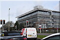
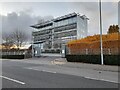
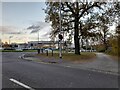
Photos of IG10 3FT

Area Information
Living in IG10 3FT means inhabiting a compact, densely populated postcode area spanning just 4.5 hectares. With 1,758 residents, the community is tightly knit, characterised by a median age of 47 and a population density of 39,058 people per square kilometre. This small cluster of homes is defined by its proximity to key infrastructure, including multiple transport hubs and retail outlets. The area’s appeal lies in its accessibility: major roads, underground stations, and nearby airports create a seamless connection to London and surrounding regions. Daily life here is shaped by practicality, with residents relying on nearby amenities for shopping, commuting, and leisure. The predominance of flats over owner-occupied homes suggests a rental-heavy market, though the small size of the area means the immediate surroundings are crucial for quality of life. For those prioritising convenience over space, IG10 3FT offers a blend of urban proximity and residential simplicity.
- Area Type
- Postcode
- Area Size
- 4.5 hectares
- Population
- 1758
- Population Density
- 2913 people/km²
The property market in IG10 3FT is dominated by rental flats, with only 35% of homes owner-occupied. This suggests a transient population and limited availability of owner-occupied properties, particularly for buyers seeking larger homes. The small area size means the housing stock is constrained, with no indication of recent developments expanding the market. For those considering purchase, the focus would likely be on flats within the immediate vicinity, though the area’s compact nature may limit options. The predominance of rental properties also means competition for available homes could be fierce. Buyers should consider the area’s practical advantages—such as transport links and retail access—against the potential challenges of limited housing diversity and high population density.
House Prices in IG10 3FT
Showing 3 properties
| Address | Type | Beds | Baths | Last Sale Price | Last Sale Date | |
|---|---|---|---|---|---|---|
| Costa, Epping Forest Shopping Park, Langston Road, Loughton, IG10 3FT | Restaurant | - | - | - | - | |
| Pets At Home, Unit 13, Epping Forest Shopping Park, Langston Road, Loughton, IG10 3FT | retail_financial | - | - | - | - | |
| Managers Office, Epping Forest Shopping Park, Langston Road, Loughton, IG10 3FT | Office | - | - | - | - |
Energy Efficiency in IG10 3FT
Residents of IG10 3FT have access to a range of practical amenities within walking or short transit distance. Retail options include Aldi, Sainsburys, and Iceland in Debden, providing essential shopping needs. The area’s transport network—underground, rail, and bus services—ensures easy access to London and surrounding towns. While there are no named parks or leisure facilities in the data, the proximity to major roads and transport hubs suggests opportunities for recreation beyond the immediate postcode. The presence of North Weald Airport adds to the area’s connectivity, though it may not serve as a leisure destination. Overall, the lifestyle here is defined by convenience, with daily needs met by nearby retail and transport infrastructure.
Amenities
Schools
The nearest school to IG10 3FT is Epping Forest High School, a primary institution serving the local community. While no Ofsted rating is provided, its presence indicates a basic educational infrastructure for younger residents. The absence of secondary schools or additional educational facilities within the area means families may need to look further afield for comprehensive schooling. This could be a consideration for parents prioritising proximity to schools. The single primary school available suggests a limited educational ecosystem, though it may suffice for early years education. For families requiring more options, nearby towns and transport links could provide access to broader schooling networks.
| Rank | School | Type | Entry gender | Ages |
|---|
Explore more schools in this area
Go to Schools tabDemographics
The community in IG10 3FT is predominantly composed of adults aged 30–64, with a median age of 47. Home ownership is relatively low at 35%, indicating a rental market skewed towards private tenants. The accommodation type is largely flats, reflecting the area’s compact footprint and likely influence of local housing policies. The predominant ethnic group is White, though no specific diversity metrics are provided. The high population density—39,058 people per square kilometre—suggests a mix of long-term residents and those in transitional housing. While no deprivation data is available, the age profile and housing stock imply a mature, stable population with established routines. The lack of family-centric housing types, such as larger homes, may influence the demographic balance, with fewer young families present.
Household Size
Accommodation Type
Tenure
Ethnic Group
Religion
Household Composition
Age
Household Deprivation
NS-SEC
Explore more demographic insights in this area
Go to Demographics tabPlanning
Planning Constraints
- Flood RiskPremium
- Ramsar Wetland SitesPremium
- Area of Outstanding Natural BeautyPremium
- Protected Nature ReservePremium
- Protected WoodlandPremium