Area Overview for IG10 3DG
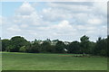
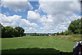
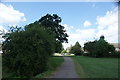
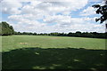
Photos of IG10 3DG


Area Information
Living in IG10 3DG offers a compact, densely populated residential experience within a 1.6-hectare area. With 1,696 residents, the community is tightly knit, reflecting the high population density of 108,499 people per square kilometre. This postcode area is a small cluster of homes, primarily houses, catering to a demographic skewed towards adults aged 30–64. Its proximity to Loughton and Buckhurst Hill provides access to broader amenities, while the immediate surroundings offer a mix of local shops and transport links. Daily life here is shaped by the balance of residential tranquillity and connectivity, though residents must be mindful of the critical flood risk in the area. Despite this, the low crime rate and availability of primary schools make it a practical choice for families seeking a compact, well-served neighbourhood. The area’s small size means it is best viewed as part of a larger network of nearby towns, rather than a standalone community.
- Area Type
- Postcode
- Area Size
- 1.6 hectares
- Population
- 1696
- Population Density
- 3619 people/km²
The property market in IG10 3DG is characterised by a 61% home ownership rate, with houses being the primary accommodation type. This suggests a market skewed towards owner-occupied properties rather than rentals, though the small area size means the housing stock is limited. The predominance of houses, unusual for a high-density postcode, may indicate a focus on family homes or larger properties. Buyers should consider the area’s compact nature and its proximity to larger towns like Loughton, where additional housing options exist. The high population density may also mean competition for properties, particularly as demand for homes with garden space or private outdoor areas is likely strong.
House Prices in IG10 3DG
Showing 10 properties
| Address | Type | Beds | Baths | Last Sale Price | Last Sale Date | |
|---|---|---|---|---|---|---|
| 5 Elmhurst Way, Loughton, IG10 3DG | Terraced | 3 | 2 | £550,000 | Jul 2024 | |
| 1 Elmhurst Way, Loughton, IG10 3DG | house | - | - | £550,000 | Nov 2020 | |
| 4 Elmhurst Way, Loughton, IG10 3DG | Terraced | 2 | - | £455,000 | Jul 2020 | |
| 2 Elmhurst Way, Loughton, IG10 3DG | Terraced | 2 | 1 | £520,000 | Aug 2019 | |
| 9 Elmhurst Way, Loughton, IG10 3DG | Terraced | 3 | 1 | £537,000 | Jan 2019 | |
| 7 Elmhurst Way, Loughton, IG10 3DG | house | - | - | £264,500 | Jan 2012 | |
| 10 Elmhurst Way, Loughton, IG10 3DG | Terraced | - | - | £375,000 | Jul 2008 | |
| 3 Elmhurst Way, Loughton, IG10 3DG | Terraced | 2 | 1 | £277,500 | Nov 2007 | |
| 8 Elmhurst Way, Loughton, IG10 3DG | Terraced | - | - | £174,000 | Aug 2002 | |
| 6 Elmhurst Way, Loughton, IG10 3DG | Terraced | - | - | - | - |
Energy Efficiency in IG10 3DG
The lifestyle in IG10 3DG is shaped by its proximity to retail hubs and transport links. Five metro stations and five rail stations provide seamless access to London, while nearby retail options include Sainsburys Loughton, M&S Loughton SF, and Waitrose Buckhurst. These stores cater to daily shopping needs, from groceries to clothing. The area’s small size means amenities are concentrated, requiring residents to venture slightly beyond the postcode for more extensive leisure options. However, the availability of multiple transport links and retail venues ensures convenience for those prioritising accessibility over expansive local facilities. The mix of retail and transport infrastructure supports a practical, commuter-friendly lifestyle.
Amenities
Schools
Residents of IG10 3DG have access to three primary schools, all named White Bridge Primary School, though one is noted to have a ‘good’ Ofsted rating. The presence of multiple primary schools within the area suggests a focus on local education, with families having choices for their children’s schooling. The ‘good’ rating at one school indicates a standard of education that meets or exceeds national benchmarks. However, the repetition of school names may reflect a single institution serving different age groups or catchment areas. For families prioritising education quality, the availability of a school with a good rating is a positive factor, though further details on secondary education options are not provided in the data.
| Rank | School | Type | Entry gender | Ages |
|---|
Explore more schools in this area
Go to Schools tabDemographics
The population of IG10 3DG is predominantly adults aged 30–64, with a median age of 47. This suggests a community of established professionals and families, reflected in the 61% home ownership rate. The majority of residents live in houses, a rarity in high-density areas, indicating a preference for standalone properties. The predominant ethnic group is White, though specific diversity metrics are not provided. The age profile implies a stable, long-term resident base, with fewer young children or retirees. The low crime risk score of 71 (level: pass) suggests a safe environment, which aligns with the area’s appeal to families. However, the high population density may impact local services and infrastructure, requiring careful planning for those considering a move.
Household Size
Accommodation Type
Tenure
Ethnic Group
Religion
Household Composition
Age
Household Deprivation
NS-SEC
Explore more demographic insights in this area
Go to Demographics tabPlanning
Planning Constraints
- Flood RiskPremium
- Ramsar Wetland SitesPremium
- Area of Outstanding Natural BeautyPremium
- Protected Nature ReservePremium
- Protected WoodlandPremium