Area Overview for IG10 2SB
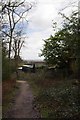
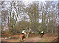
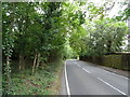
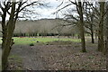
Photos of IG10 2SB


Area Information
Living in IG10 2SB offers a compact, residential experience shaped by its small footprint of 25.9 hectares and a population of 1,613 people. The area’s density of 758 people per square kilometre suggests a tightly knit community, where daily life is influenced by proximity to amenities and transport. This postcode cluster is defined by its predominantly owner-occupied housing stock, with 87% of homes owned by residents, and a strong presence of family households. The median age of 47, with the majority of residents aged 30–64, indicates a mature, stable demographic. While the area lacks large-scale infrastructure, its proximity to Loughton and surrounding towns provides access to retail, transport, and services. The mix of local shops, public transport, and green spaces creates a balance between convenience and tranquillity, appealing to those seeking a suburban lifestyle without the sprawl of larger towns.
- Area Type
- Postcode
- Area Size
- 25.9 hectares
- Population
- 1613
- Population Density
- 758 people/km²
The property market in IG10 2SB is characterised by high home ownership (87%) and a focus on houses rather than flats or apartments. This suggests a market skewed towards owner-occupied properties, likely attracting buyers seeking long-term investment or family homes. The small area size and limited housing stock mean the market is not expansive, but the presence of nearby towns like Loughton offers additional options for those seeking larger properties or different neighbourhoods. The predominance of houses implies a demand for space and privacy, which could appeal to professionals or families. However, the compact nature of the postcode means buyers must consider proximity to amenities and transport as critical factors when evaluating properties.
House Prices in IG10 2SB
Showing 45 properties
| Address | Type | Beds | Baths | Last Sale Price | Last Sale Date | |
|---|---|---|---|---|---|---|
| 34 Broadstrood, Loughton, IG10 2SB | Detached | 4 | 1 | £1,100,000 | Aug 2023 | |
| Oscoda, 31 Broadstrood, Loughton, IG10 2SB | Detached | 3 | 1 | £1,280,000 | Mar 2023 | |
| 55 Broadstrood, Loughton, IG10 2SB | Detached | 5 | 3 | £1,485,000 | May 2022 | |
| 20 Broadstrood, Loughton, IG10 2SB | Detached | 4 | 2 | £1,140,000 | Jun 2021 | |
| 35 Broadstrood, Loughton, IG10 2SB | Detached | 5 | - | £1,521,550 | May 2021 | |
| 25 Broadstrood, Loughton, IG10 2SB | Detached | 6 | 5 | £2,050,000 | Feb 2021 | |
| 59 Broadstrood, Loughton, IG10 2SB | Detached | 5 | 3 | £1,900,000 | Sep 2019 | |
| 51 Broadstrood, Loughton, IG10 2SB | Detached | 2 | 3 | £1,000,000 | Jan 2018 | |
| 43 Broadstrood, Loughton, IG10 2SB | Detached | 6 | 4 | £1,920,000 | Sep 2017 | |
| 10 Broadstrood, Loughton, IG10 2SB | Detached | 4 | 2 | £1,450,000 | Aug 2017 |
Energy Efficiency in IG10 2SB
Daily life in IG10 2SB is shaped by its proximity to retail, transport, and natural spaces. The area’s retail options include Lidl, Sainsburys, and Morrisons in Loughton, offering essential shopping within a short distance. Transport links to underground and rail stations provide easy access to London and nearby towns, while North Weald Airport adds convenience for travel. The surrounding landscape includes protected nature reserves and woodlands, though these areas may impose planning constraints on development. Despite these limitations, the blend of local amenities and green spaces creates a lifestyle that balances practicality with natural beauty, appealing to those who value both accessibility and environmental preservation.
Amenities
Schools
The nearest school to IG10 2SB is Woodcroft School, a special school with an Ofsted rating of ‘good’. This institution caters to students with specific educational needs, offering tailored support and resources. While no other schools are listed in the data, the presence of a special school indicates that the area may attract families requiring specialist education for their children. For those seeking mainstream schooling, nearby towns like Loughton likely provide additional options, though specific details are not included here. The quality of Woodcroft School, combined with its ‘good’ rating, suggests a reliable educational resource for residents with particular needs.
| Rank | School | Type | Entry gender | Ages |
|---|
Explore more schools in this area
Go to Schools tabDemographics
The community in IG10 2SB is predominantly composed of adults aged 30–64, with a median age of 47. This suggests a population focused on established careers and family life, with fewer young families or retirees compared to other areas. Home ownership is high at 87%, reflecting a preference for long-term residency over renting. The accommodation type is largely houses, which aligns with the area’s suburban character. The predominant ethnic group is White, though specific diversity data is not provided. The population density of 758 people per square kilometre indicates a moderate level of urbanisation, balancing private space with community interaction. For buyers, this profile suggests a neighbourhood where stability and familiarity are key, with limited turnover in the housing market.
Household Size
Accommodation Type
Tenure
Ethnic Group
Religion
Household Composition
Age
Household Deprivation
NS-SEC
Explore more demographic insights in this area
Go to Demographics tabPlanning
Planning Constraints
- Flood RiskPremium
- Ramsar Wetland SitesPremium
- Area of Outstanding Natural BeautyPremium
- Protected Nature ReservePremium
- Protected WoodlandPremium