Area Overview for IG10 2JS
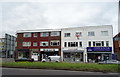
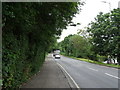
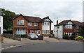
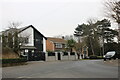
Photos of IG10 2JS


Area Information
Living in IG10 2JS means inhabiting a compact, high-density residential cluster in England’s eastern suburbs. The area covers 6,610 square metres, housing 1,603 residents at a population density of 242,501 people per square kilometre. This suggests a tightly knit community, where proximity to neighbours is inevitable. The postcode is notable for its accessibility to London’s transport network, with multiple underground and rail stations within reach. Daily life here is shaped by its position as a commuter hub, with residents likely working in nearby urban centres. The area’s character is defined by its mature demographic: the median age is 47, with most residents aged 30–64. This reflects a stable, established community, though the high density may mean limited private outdoor space. For those prioritising convenience over sprawling landscapes, IG10 2JS offers a compact, well-connected environment with amenities within practical reach. However, the small size means the area is best suited to those seeking a focused, urbanised lifestyle rather than expansive living.
- Area Type
- Postcode
- Area Size
- 6610 m²
- Population
- 1603
- Population Density
- 5970 people/km²
The property market in IG10 2JS is defined by its high density and the prevalence of flats. With 47% of residents owning their homes, the area leans more towards a rental market than outright ownership. This is typical for smaller, urbanised postcodes where housing stock is limited. The dominance of flats suggests a focus on compact, efficient living, which may appeal to commuters or those prioritising convenience over larger properties. Given the area’s small size, the housing options are likely constrained, making it a niche market for buyers seeking specific types of flats. The high population density also means that properties are closely spaced, which could be a consideration for those desiring more private space. For buyers, the area’s proximity to transport links and amenities may outweigh the limitations of its size, though the lack of expansive housing options should be acknowledged.
House Prices in IG10 2JS
Showing 15 properties
| Address | Type | Beds | Baths | Last Sale Price | Last Sale Date | |
|---|---|---|---|---|---|---|
| 4 Hillyfields, Loughton, IG10 2JS | Semi-detached | 3 | 1 | £512,000 | Jun 2022 | |
| 6 Hillyfields, Loughton, IG10 2JS | house | - | - | £530,000 | Aug 2021 | |
| 14 Hillyfields, Loughton, IG10 2JS | house | - | - | £485,000 | May 2021 | |
| 12 Hillyfields, Loughton, IG10 2JS | Semi-detached | 4 | 2 | £535,000 | Sep 2017 | |
| 18 Hillyfields, Loughton, IG10 2JS | Semi-detached | 3 | 1 | £467,500 | Apr 2017 | |
| 10 Hillyfields, Loughton, IG10 2JS | house | 4 | 1 | £490,000 | Feb 2016 | |
| 26 Hillyfields, Loughton, IG10 2JS | house | - | - | £249,000 | Feb 2013 | |
| 2 Hillyfields, Loughton, IG10 2JS | Semi-detached | 4 | 2 | £217,000 | Apr 2006 | |
| 16 Hillyfields, Loughton, IG10 2JS | house | - | - | £166,000 | Oct 2001 | |
| 28 Hillyfields, Loughton, IG10 2JS | Detached | 4 | 2 | - | - |
Energy Efficiency in IG10 2JS
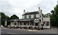
Residents of IG10 2JS have access to a range of amenities within practical reach, including retail outlets such as Lidl Loughton, Sainsburys Loughton, and Iceland Debden. These stores provide convenience for everyday shopping needs. The area’s transport links also grant easy access to leisure and travel opportunities, with the nearby North Weald Airport offering flight connections. While the data does not specify parks or recreational spaces, the presence of multiple underground and rail stations suggests a focus on connectivity over expansive green areas. The high number of retail and transport options indicates a lifestyle prioritising accessibility and efficiency. For those who value proximity to shops, public transport, and travel hubs, IG10 2JS offers a practical, well-served environment. However, the small size of the area may limit opportunities for larger-scale leisure or outdoor activities.
Amenities
Schools
| Rank | School | Type | Entry gender | Ages |
|---|
Explore more schools in this area
Go to Schools tabDemographics
The community in IG10 2JS is predominantly composed of adults aged 30–64, with a median age of 47. This suggests a mature population, likely settled in long-term careers or retirement. Home ownership is relatively low at 47%, indicating that a majority of residents are likely renting, which could reflect the area’s role as a commuter zone. The accommodation type is primarily flats, a common feature in high-density areas. The predominant ethnic group is White, though specific diversity statistics are not provided. The population density of 242,501 per square kilometre is exceptionally high, which may influence the character of daily life, with limited private outdoor space and a focus on shared amenities. This density could also mean a strong sense of community, though it may challenge those seeking more spacious living conditions. The data does not indicate levels of deprivation, but the high proportion of renters and the age profile suggest a stable, working-age population.
Household Size
Accommodation Type
Tenure
Ethnic Group
Religion
Household Composition
Age
Household Deprivation
NS-SEC
Explore more demographic insights in this area
Go to Demographics tabPlanning
Planning Constraints
- Flood RiskPremium
- Ramsar Wetland SitesPremium
- Area of Outstanding Natural BeautyPremium
- Protected Nature ReservePremium
- Protected WoodlandPremium