Area Overview for IG10 2JA
Photos of IG10 2JA


Area Information
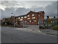
Living in IG10 2JA means inhabiting a compact, residential postcode area in England, spanning just 1.1 hectares and home to 1,636 people. The population density of 1,182 people per square kilometre reflects a tightly knit community, with homes predominantly in the form of houses rather than flats. This small area is positioned near key infrastructure, including multiple transport hubs and retail spots, making daily life convenient. The demographic profile suggests a mature population, with a median age of 47 and most residents falling within the 30-64 age range. This hints at a community of long-term residents, many of whom may be raising families or settling into retirement. The area’s proximity to schools, shops, and public transport means residents can balance local amenities with broader connectivity. While the population is small, the density and mix of services suggest a functional, if modest, urban environment. For buyers, the limited size of the area means properties here are likely to be in close proximity to each other, with a focus on established housing rather than new developments.
- Area Type
- Postcode
- Area Size
- 1.1 hectares
- Population
- 1636
- Population Density
- 1182 people/km²
The property market in IG10 2JA is defined by a 54% home ownership rate, indicating that nearly half of the area’s housing stock is owner-occupied. This contrasts with a 46% rental market, suggesting a mix of long-term residents and those seeking temporary or flexible housing. The accommodation type is predominantly houses, which is unusual for a small postcode area but may reflect a focus on family homes or older properties. Given the area’s limited size—just 1.1 hectares—housing options are constrained, with properties likely to be closely spaced. Buyers should consider that the small footprint means limited scope for expansion or new developments. The presence of nearby schools and transport links may make this area appealing to those prioritising convenience over space. However, the compact nature of IG10 2JA means that property values and availability are likely to be tightly bound to local demand and supply.
House Prices in IG10 2JA
Showing 16 properties
| Address | Type | Beds | Baths | Last Sale Price | Last Sale Date | |
|---|---|---|---|---|---|---|
| 14 Mannock Drive, Loughton, IG10 2JA | house | - | - | £385,000 | Nov 2021 | |
| 10 Mannock Drive, Loughton, IG10 2JA | house | - | - | £355,000 | Mar 2018 | |
| 18 Mannock Drive, Loughton, IG10 2JA | Semi-detached | 3 | 1 | £370,000 | Mar 2016 | |
| 28 Mannock Drive, Loughton, IG10 2JA | Terraced | 3 | 1 | £300,000 | Apr 2015 | |
| 16 Mannock Drive, Loughton, IG10 2JA | Terraced | 2 | 1 | £325,000 | Dec 2014 | |
| 26 Mannock Drive, Loughton, IG10 2JA | house | - | - | £285,000 | Nov 2013 | |
| 22 Mannock Drive, Loughton, IG10 2JA | house | - | - | £240,000 | Dec 2012 | |
| 8 Mannock Drive, Loughton, IG10 2JA | Terraced | - | - | £240,000 | Aug 2007 | |
| 2 Mannock Drive, Loughton, IG10 2JA | Bungalow | 1 | 1 | £30,000 | Jun 1999 | |
| 24 Mannock Drive, Loughton, IG10 2JA | Terraced | 3 | 1 | £88,950 | Jul 1997 |
Energy Efficiency in IG10 2JA
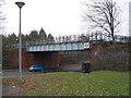
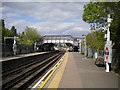
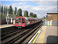
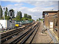
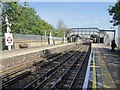
Residents of IG10 2JA have access to a range of amenities within practical reach, enhancing daily life. Retail options include Iceland Debden, M&S Chigwell BP, and Sainsburys Debden, providing grocery and general shopping needs. The area’s proximity to underground and rail stations ensures easy access to larger urban centres, while the nearby Whipps Cross Bus Interchange connects to broader regional routes. Though the area is small, the presence of multiple transport hubs and retail outlets suggests a functional, if compact, lifestyle. Parks and green spaces are not explicitly listed in the data, but the absence of protected natural areas implies limited recreational land. Nonetheless, the convenience of nearby schools, shops, and transport makes IG10 2JA suitable for those prioritising accessibility over expansive outdoor spaces. The mix of retail and transport options ensures that daily errands and commuting are efficient, supporting a balanced urban lifestyle.
Amenities
Schools
Residents of IG10 2JA have access to a range of schools, including primary and academy institutions. St John Fisher Catholic Primary School and Thomas Willingale Primary School and Nursery cater to younger children, with the latter holding a ‘good’ Ofsted rating. Debden Park High School serves both primary and secondary education, though its academy status and ‘outstanding’ Ofsted rating highlight its quality. The presence of multiple schools in close proximity offers families flexibility, with options for both state and academy-led education. The mix of school types suggests a varied educational landscape, though the absence of secondary schools in the immediate area may require commuting for older students. For parents, the availability of a ‘good’ and ‘outstanding’ rated school nearby is a key consideration, though the limited number of institutions may reduce competition for places.
| Rank | School | Type | Entry gender | Ages |
|---|
Explore more schools in this area
Go to Schools tabDemographics
The community in IG10 2JA is predominantly composed of adults aged 30-64, with a median age of 47. This suggests a population that is largely settled, with fewer young families or retirees compared to other areas. Home ownership stands at 54%, indicating a moderate balance between owner-occupied properties and rental homes. The accommodation type is primarily houses, which aligns with the area’s compact size and residential character. The predominant ethnic group is White, reflecting a homogenous demographic profile. While no specific data on deprivation is provided, the age distribution and home ownership rate imply a stable, middle-income community. The absence of significant diversity data means the area’s cultural composition remains largely unexplored in this context. For residents, the age profile suggests a focus on family-oriented living, with schools and local amenities playing a central role in daily life.
Household Size
Accommodation Type
Tenure
Ethnic Group
Religion
Household Composition
Age
Household Deprivation
NS-SEC
Explore more demographic insights in this area
Go to Demographics tabPlanning
Planning Constraints
- Flood RiskPremium
- Ramsar Wetland SitesPremium
- Area of Outstanding Natural BeautyPremium
- Protected Nature ReservePremium
- Protected WoodlandPremium