Area Overview for IG10 2EN
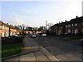
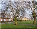
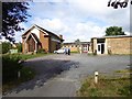
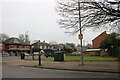
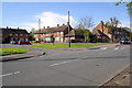
Photos of IG10 2EN


Area Information
Living in IG10 2EN offers a compact, residential experience within a small cluster of homes. With a population of 1,636 spread over 2,086 square metres, the area maintains a dense yet manageable footprint, typical of suburban London’s outer reaches. The community is largely composed of adults aged 30–64, reflecting a mature demographic with established roots. Daily life here balances proximity to essential services with a quieter, more residential character. Nearby amenities include multiple retail outlets, underground stations, and schools, making it practical for commuters and families. The area’s small size means it is tightly integrated with surrounding districts, offering access to broader opportunities without the congestion of central London. Residents benefit from a blend of local shops, transport links, and educational institutions, creating a self-contained yet connected environment. The high broadband score and accessible rail networks further enhance its appeal for those prioritising connectivity and convenience.
- Area Type
- Postcode
- Area Size
- 2086 m²
- Population
- 1636
- Population Density
- 1182 people/km²
The property market in IG10 2EN is defined by a 54% home ownership rate, indicating that nearly half of the area’s housing stock is owner-occupied. The predominant accommodation type is houses, which contrasts with areas dominated by flats or apartments. This suggests a community of established residents, with properties likely ranging from family homes to smaller detached units. Given the area’s small size, the housing stock is limited, and buyers should consider proximity to key amenities and transport links as critical factors. The compact nature of the postcode means that properties are closely clustered, potentially offering a mix of characterful homes and modern developments. For buyers, the focus would be on securing a house in a well-connected location, given the area’s reliance on nearby stations and retail hubs. The market may cater more to owner-occupiers than to investors, reflecting the demographic’s stability.
House Prices in IG10 2EN
Showing 8 properties
| Address | Type | Beds | Baths | Last Sale Price | Last Sale Date | |
|---|---|---|---|---|---|---|
| 41 Audley Gardens, Loughton, IG10 2EN | house | 2 | - | £430,000 | Jun 2021 | |
| 37 Audley Gardens, Loughton, IG10 2EN | Bungalow | 1 | - | £237,000 | Aug 2020 | |
| 31 Audley Gardens, Loughton, IG10 2EN | Terraced | 3 | 1 | £452,000 | Jul 2018 | |
| 35 Audley Gardens, Loughton, IG10 2EN | Terraced | 2 | - | £340,000 | May 2017 | |
| 33 Audley Gardens, Loughton, IG10 2EN | Bungalow | 1 | - | - | - | |
| 45 Audley Gardens, Loughton, IG10 2EN | house | - | - | - | - | |
| 43 Audley Gardens, Loughton, IG10 2EN | Terraced | - | - | - | - | |
| 39 Audley Gardens, Loughton, IG10 2EN | Bungalow | - | - | - | - |
Energy Efficiency in IG10 2EN
The lifestyle in IG10 2EN is shaped by its proximity to practical amenities, including retail, dining, and transport. Local shops such as Iceland Debden, M&S Chigwell BP, and Sainsburys Debden provide essential grocery and retail services, reducing the need for long trips. The area’s transport links are extensive, with five metro stations and five rail stations within reach, facilitating easy access to London and surrounding towns. While the data does not specify parks or leisure facilities, the presence of multiple schools and retail outlets suggests a community-focused environment. The combination of retail convenience and transport connectivity ensures that daily life is efficient, with minimal reliance on cars. The area’s compact size means that residents can access these amenities without significant travel, enhancing the overall quality of life.
Amenities
Schools
Residents of IG10 2EN have access to a range of educational institutions, including primary schools and an outstanding academy. St John Fisher Catholic Primary School and Thomas Willingale Primary School and Nursery are both primary schools, with the latter holding a ‘good’ Ofsted rating. Debden Park High School is listed twice in the data: once as a primary school and once as an academy with an ‘outstanding’ rating. This mix of school types provides families with options, from faith-based education to state-funded academies. The presence of an outstanding-rated academy suggests high academic standards in at least one institution, which may attract families prioritising quality education. The proximity of these schools to the area reinforces its appeal for households with children, ensuring accessibility to both primary and secondary-level schooling.
| Rank | School | Type | Entry gender | Ages |
|---|
Explore more schools in this area
Go to Schools tabDemographics
The community in IG10 2EN is predominantly composed of adults aged 30–64, with a median age of 47. Home ownership sits at 54%, indicating a stable, long-term resident base, while the remaining 46% of households are likely renters. The area is characterised by a high proportion of houses rather than flats, reflecting a preference for standalone properties. The predominant ethnic group is White, though no specific diversity metrics are provided. The population density of 1,182 people per square kilometre suggests a mix of family homes and smaller dwellings, but the exact distribution of household types is not specified. The age profile suggests a community of professionals and families, with fewer younger or elderly residents. This demographic profile may influence local services and amenities, with a focus on schools and transport tailored to working-age adults and school-age children.
Household Size
Accommodation Type
Tenure
Ethnic Group
Religion
Household Composition
Age
Household Deprivation
NS-SEC
Explore more demographic insights in this area
Go to Demographics tabPlanning
Planning Constraints
- Flood RiskPremium
- Ramsar Wetland SitesPremium
- Area of Outstanding Natural BeautyPremium
- Protected Nature ReservePremium
- Protected WoodlandPremium