Area Overview for IG10 1RH
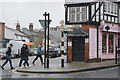
Photos of IG10 1RH


Area Information
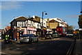
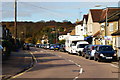
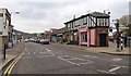
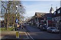
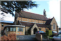
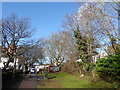
Living in IG10 1RH means being part of a tightly knit residential cluster in north-east London. With a population of 1,688, this area is small but functional, offering a quiet alternative to the city’s busier zones. The community here is predominantly made up of adults aged 30–64, reflecting a mature demographic with established routines. Daily life is shaped by proximity to transport links and local amenities, with residents able to access shops, schools, and public transport within walking or short driving distance. The area’s compact size means it is easy to navigate, and its location near Loughton and surrounding towns provides a balance between suburban comfort and urban accessibility. While not a high-density zone, IG10 1RH is well-served by nearby retail hubs and transport networks, making it a practical choice for those seeking a settled, low-maintenance lifestyle without sacrificing connectivity. The area’s character is defined by its mix of homes, community-focused services, and a population that prioritises stability over rapid change.
- Area Type
- Postcode
- Area Size
- Not available
- Population
- 1688
- Population Density
- 4743 people/km²
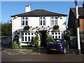
The property market in IG10 1RH is characterised by a high rate of home ownership—69% of residents own their homes. This suggests a strong preference for private, long-term residency over rental living, which may reflect the area’s appeal to established families and professionals. The accommodation type is predominantly houses, which are more common than flats or apartments. This housing stock indicates a focus on single-family living, with properties likely to be spacious and suited to those seeking a quieter, more private environment. Given the area’s small size, the housing market is likely to be limited in scale, with opportunities for buyers concentrated within the immediate vicinity. The high ownership rate also implies that the area is not a major rental hotspot, which could be a consideration for those prioritising investment potential over immediate purchase.
House Prices in IG10 1RH
Showing 1 properties
| Address | Type | Beds | Baths | Last Sale Price | Last Sale Date | |
|---|---|---|---|---|---|---|
| Dwp, Job Centre, 284 High Road, Loughton, IG10 1RH | office_workshop | - | - | - | - |
Energy Efficiency in IG10 1RH
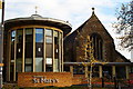
Residents of IG10 1RH have access to a range of amenities that support both practical needs and leisure. The area is within reach of five retail outlets, including Morrisons Loughton, Cook Loughton, and M&S Loughton SF, providing options for grocery shopping and daily essentials. Public transport is extensive, with five nearby underground stations, three rail stations, and a bus interchange at Whipps Cross, ensuring easy movement within and beyond the area. While specific parks or leisure facilities are not detailed in the data, the proximity to Loughton and surrounding towns suggests access to green spaces and community centres. The combination of retail, transport, and nearby schools creates a convenient, self-contained lifestyle, with residents able to meet most needs without significant travel.
Amenities
Schools
Residents of IG10 1RH have access to several primary schools within close proximity, including Staples Road Junior School, Staples Road Infant School, Roding Valley High School, Loughton High School, and Staples Road Primary School. While specific Ofsted ratings are not provided, the presence of multiple schools suggests a focus on education within the community. The mix of primary schools indicates that families with young children have options for early education, though the absence of secondary schools means students may need to travel to nearby areas for higher education. The density of primary schools may also reflect the area’s role as a residential hub for families, with parents prioritising local schooling for their children.
| Rank | School | Type | Entry gender | Ages |
|---|
Explore more schools in this area
Go to Schools tabDemographics
The community in IG10 1RH is predominantly composed of adults aged 30–64, with a median age of 47. This suggests a population that is largely in their prime working years, with a strong presence of families and long-term residents. Home ownership is high, at 69%, indicating a stable housing market where most residents own their properties rather than rent. The accommodation type is primarily houses, which aligns with the area’s residential character and suggests a preference for private, detached living. The predominant ethnic group is White, reflecting a community with a consistent cultural profile. While specific data on deprivation is not provided, the high home ownership rate and mature age demographic imply a relatively stable economic environment. This stability may contribute to a sense of continuity in the area, with residents likely to have long-term ties to their local surroundings.
Household Size
Accommodation Type
Tenure
Ethnic Group
Religion
Household Composition
Age
Household Deprivation
NS-SEC
Explore more demographic insights in this area
Go to Demographics tabPlanning
Planning Constraints
- Flood RiskPremium
- Ramsar Wetland SitesPremium
- Area of Outstanding Natural BeautyPremium
- Protected Nature ReservePremium
- Protected WoodlandPremium