Area Overview for IG10 1NG
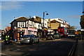
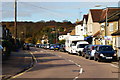
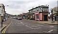
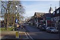
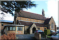
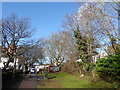
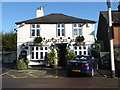
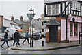
Photos of IG10 1NG


Area Information
Living in IG10 1NG means inhabiting a small, tightly knit residential cluster in England with a population of just 1,601. This area is defined by its compact size and the presence of traditional housing, with 92% of properties owned by residents rather than rented. The community here is predominantly composed of adults aged 30–64, reflecting a mature, stable demographic. Daily life is shaped by the proximity to essential services, including multiple retail outlets and transport hubs. While the area is not expansive, its strategic location near Loughton and surrounding towns ensures access to broader amenities. The low crime risk and absence of environmental constraints like flood zones or protected landscapes contribute to a sense of security and practicality. For those seeking a quiet, family-friendly environment with minimal urban sprawl, IG10 1NG offers a blend of residential comfort and connectivity to nearby infrastructure.
- Area Type
- Postcode
- Area Size
- Not available
- Population
- 1601
- Population Density
- 2330 people/km²
The property market in IG10 1NG is characterised by high home ownership (92%) and a focus on houses rather than flats or apartments. This suggests a predominantly owner-occupied area with limited rental activity, likely attracting buyers seeking long-term stability. The concentration of houses indicates a traditional, low-density housing stock, which may appeal to families or individuals prioritising space and privacy. Given the area’s small size, the immediate surroundings likely offer similar housing types, reinforcing a cohesive local character. For buyers, this means a market where properties are likely to remain in private hands for extended periods, reducing competition from short-term renters. However, the limited data on property prices or availability means potential buyers should consider broader regional trends when assessing investment potential.
House Prices in IG10 1NG
No properties found in this postcode.
Energy Efficiency in IG10 1NG
Daily life in IG10 1NG is supported by a range of nearby amenities, including five retail outlets such as Cook Loughton, Morrisons Loughton, and Sainsburys Loughton. These shops provide essential services, from groceries to household goods, reducing the need for long trips. The proximity to multiple underground and rail stations, including Loughton and Buckhurst Hill, ensures easy access to London’s transport network, while the Whipps Cross Bus Interchange connects residents to surrounding areas. Though the area itself is small, its strategic location means residents can enjoy the vibrancy of nearby towns without sacrificing convenience. The mix of retail, transport, and connectivity options creates a practical lifestyle, balancing local needs with broader opportunities.
Amenities
Schools
| Rank | School | Type | Entry gender | Ages |
|---|
Explore more schools in this area
Go to Schools tabDemographics
The population of IG10 1NG is 1,601, with a median age of 47. This suggests a community skewed towards middle-aged and older adults, with the most common age range being 30–64 years. Home ownership is exceptionally high at 92%, indicating a long-term, settled population. The accommodation type is primarily houses, reflecting a preference for standalone properties over flats or apartments. The predominant ethnic group is White, which aligns with broader regional trends. The absence of specific data on deprivation means no direct commentary on economic hardship, but the high home ownership rate and mature age profile suggest a relatively stable socioeconomic environment. This demographic profile implies a community focused on long-term living, with fewer transient residents compared to areas with higher rental markets.
Household Size
Accommodation Type
Tenure
Ethnic Group
Religion
Household Composition
Age
Household Deprivation
NS-SEC
Explore more demographic insights in this area
Go to Demographics tabPlanning
Planning Constraints
- Flood RiskPremium
- Ramsar Wetland SitesPremium
- Area of Outstanding Natural BeautyPremium
- Protected Nature ReservePremium
- Protected WoodlandPremium