Area Overview for IG10 1HW
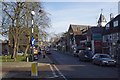
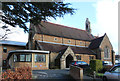
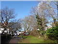
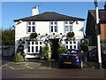
Photos of IG10 1HW


Area Information
Living in IG10 1HW means being part of a tightly knit residential cluster in England, where 1,688 people reside across 2,364 square metres. This small area is characterised by a high population density of 714,064 people per square kilometre, reflecting its compact nature. The community is predominantly composed of adults aged 30–64, with a median age of 47, suggesting a mature, stable population. Daily life here is shaped by proximity to essential services, including five primary schools and multiple transport hubs. The area’s small size means residents are likely to know their neighbours, though the high density may contribute to a more urbanised feel. Proximity to Loughton and surrounding stations offers easy access to London’s transport network, while local amenities like Morrisons and M&S provide convenience. However, the area’s compactness also means limited green space, with no protected natural sites nearby. For buyers, this postcode offers a mix of practicality and accessibility, though the high population density may influence property availability and pricing.
- Area Type
- Postcode
- Area Size
- 2364 m²
- Population
- 1688
- Population Density
- 4743 people/km²
The property market in IG10 1HW is dominated by owner-occupied homes, with 69% of residents owning their properties. This high home ownership rate suggests a stable, long-term community with limited rental activity. The accommodation type is primarily houses, which is unusual for a small postcode area, indicating a mix of larger properties. This may reflect a focus on family homes or detached housing, though the compact size of the area means space is limited. Buyers should note that the small footprint of IG10 1HW means property availability is constrained, and competition may be fierce. The predominance of houses could also mean higher price points compared to areas with more flats or terraced housing. For those seeking a home in this area, the market is likely to prioritise buyers with specific needs, such as larger families or those requiring more space.
House Prices in IG10 1HW
No properties found in this postcode.
Energy Efficiency in IG10 1HW
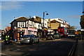
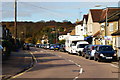
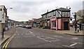
The lifestyle in IG10 1HW is shaped by its proximity to retail and transport hubs. Local shops include Morrisons Loughton, Cook Loughton, and M&S Loughton, providing everyday essentials. The area’s transport links to Loughton and surrounding stations make it easy to access larger shopping centres or leisure facilities further afield. While the data does not mention parks or recreational spaces, the absence of protected natural sites suggests limited green areas. The convenience of nearby amenities, combined with the ease of commuting, makes daily life efficient. However, the high population density may mean limited private outdoor space for residents. The mix of retail and transport options supports a practical, urban lifestyle, though buyers should consider whether the lack of expansive parks or recreational facilities aligns with their preferences.
Amenities
Schools
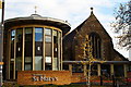
Residents of IG10 1HW have access to five primary schools within practical reach: Staples Road Junior School, Staples Road Infant School, Roding Valley High School, Loughton High School, and Staples Road Primary School. While no Ofsted ratings are provided, the concentration of primary schools suggests a strong focus on early education. The presence of multiple schools may indicate a demand for local schooling, though the lack of secondary schools in the area could require families to travel further for higher education. The variety of primary schools may offer options for different educational philosophies or needs, though the exact quality of these institutions remains unspecified. For families prioritising proximity to schools, this area provides a clear advantage, though buyers should investigate further into specific school performance metrics beyond the data provided.
| Rank | School | Type | Entry gender | Ages |
|---|
Explore more schools in this area
Go to Schools tabDemographics
The population of IG10 1HW is predominantly adults aged 30–64, with a median age of 47. This suggests a community focused on family life and long-term settlement. Home ownership is high at 69%, with houses being the primary accommodation type. This indicates a stable, owner-occupied market rather than a rental-heavy area. The predominant ethnic group is White, though no specific diversity statistics are provided. The age profile implies a balance between working-age individuals and retirees, with fewer children in the population. However, the presence of five primary schools suggests families are a significant part of the community. The high home ownership rate may reflect long-term residency, but the lack of detailed diversity data means the full demographic picture remains incomplete. For buyers, this area may appeal to those seeking a mature, established neighbourhood with limited turnover.
Household Size
Accommodation Type
Tenure
Ethnic Group
Religion
Household Composition
Age
Household Deprivation
NS-SEC
Explore more demographic insights in this area
Go to Demographics tabPlanning
Planning Constraints
- Flood RiskPremium
- Ramsar Wetland SitesPremium
- Area of Outstanding Natural BeautyPremium
- Protected Nature ReservePremium
- Protected WoodlandPremium