Area Overview for Ickworth
Photos of Ickworth


Area Information
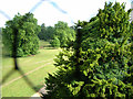
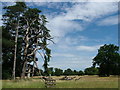
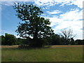
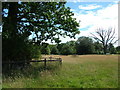
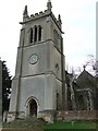
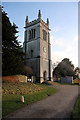
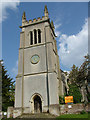
Living in Ickworth offers a distinct experience within a small civil parish located in England. This area covers a total size of 5.1 km², confined enough to foster a close-knit community yet open to surrounding countryside. You will find a quiet environment where daily life revolves around local rhythms rather than rapid urban growth. The demographic profile indicates a mature community, with a median age of 70 years reflecting a neighbourhood largely settled by older residents. This suggests a atmosphere of stability and perhaps a slower pace compared to busier market towns. Homes in Ickworth sit within an area that has successfully passed safety assessments for flood risk and crime, with a specific safety score of 82 out of 100. You do not live under the shadow of major planning constraints such as Areas of Outstanding Natural Beauty or Ramsar sites, though you are adjacent to protected woodland which contributes 5.52 points to any planning score. The lack of diverse household composition data hints at a traditional settlement structure. For those seeking a somewhere defined by low crime rates and established character, this parish presents a clear option. It is a place where the footprint of development is minimal compared to its natural surroundings.
- Area Type
- Parish
- Area Size
- 5.1 km²
- Population
- Not available
- Population Density
- Not available
Demographics
The community in Ickworth is defined by a very specific age profile, making it unique among English parishes. With a median age of 70, you are looking at an area dominated by seniors rather than a typical mix of young families or working-age adults. While the data lists the most common age range simply as "Age: Total," the central tendency clearly points to retirement living. You will likely encounter neighbours who have called this home for decades, valuing local traditions over transient trends. Approximately 80% of households in Ickworth are owner-occupied, a figure that underscores the long-term residency of the population. This high level of ownership typically means properties are well maintained by those who intend to stay put rather than investors seeking quick turnovers. The household composition data is recorded as total, and ethnicity and religion data are similarly noted as total, suggesting the provided statistics focus on the aggregate population rather than granular diversity metrics. Despite the age skew, the area remains safe with a crime risk assessment confirming below-average rates. You can expect a supportive environment where social goods are shared among a demographic that values independence and privacy within their own gardens.
Household Size
Accommodation Type
Tenure
Ethnic Group
Religion
Household Composition
Age
Household Deprivation
NS-SEC
Explore more demographic insights in this area
Go to Demographics tabPlanning
Planning Constraints
- Flood RiskPremium
- Ramsar Wetland SitesPremium
- Area of Outstanding Natural BeautyPremium
- Protected Nature ReservePremium
- Protected WoodlandPremium
- Crime RiskPremium