Area Overview for Hutton North Ward
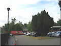
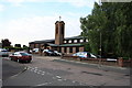
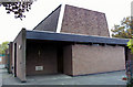
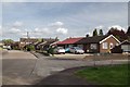
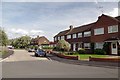
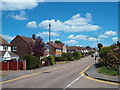
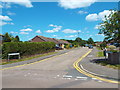
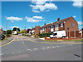
Photos of Hutton North Ward
Area Information
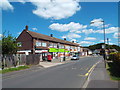
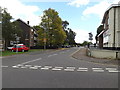
Hutton North Ward occupies a distinct position within the Brentwood borough, covering an area of 2.0 km². It sits approximately 5 km east of the Brentwood town centre, establishing itself as a residential suburb on the eastern edge of the built-up area. This ward holds a total population of 2,512 residents, creating a tightly knit community rather than a sprawling sprawl. The name derives from a historic farm or settlement located on a prominent hill spur, reflecting the area's deep roots in the landscape. Living here means residing in a part of Essex with documented history stretching back to the Domesday Book of 1086. You are likely to encounter the parish church of All Saints, which dates to the early 14th century and was largely rebuilt in 1873. The area also incorporates Hutton Poplars, a significant historical site converted in 1991 into an adult community learning centre. Daily life centres around this established locality, offering a quiet existence away from the immediate bustle of the main town while remaining accessible to local amenities. The ward functions as a stable residential pocket where the past informs the present character of the neighbourhood.
- Area Type
- District Borough Unitary Ward
- Area Size
- 2.0 km²
- Population
- Not available
- Population Density
- Not available
Demographics
The community in Hutton North Ward displays an older demographic profile compared to the national average. The median age of residents is 70, indicating that the constituency is predominantly populated by older adults. While the data lists the most common age range as 'Age: Total', the central tendency clearly points toward a mature population structure. This suggests a neighbourhood where retirement living and static generations are the norm rather than young families raising children in the immediate vicinity. Home ownership is a defining feature of the local community, with 65% of households owning their properties outright or with a mortgage. This high ownership rate implies a settled population with strong ties to the address. The ward contains a mix of accommodation types, though the specific breakdown between single-family homes and flats is not detailed in the provided figures. Diversity metrics for ethnicity, religion, and household composition are available as total figures but do not specify the dominant group in the text provided. The area is characterised by stability and long-term residency, appealing to those seeking a permanent home in a historic part of Brentwood.
Household Size
Accommodation Type
Tenure
Ethnic Group
Religion
Household Composition
Age
Household Deprivation
NS-SEC
Explore more demographic insights in this area
Go to Demographics tabPlanning
Planning Constraints
- Flood RiskPremium
- Ramsar Wetland SitesPremium
- Area of Outstanding Natural BeautyPremium
- Protected Nature ReservePremium
- Protected WoodlandPremium
- Crime RiskPremium