Area Overview for Hutton East Ward
Photos of Hutton East Ward


Area Information
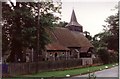
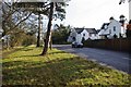
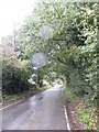
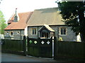
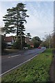
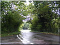
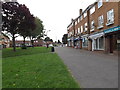
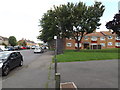
Hutton East Ward defines the character of suburban life in East Essex, situated approximately five kilometres east of Brentwood town centre. This district ward covers an area of 6.6 km², holding the designation of a local borough unitary ward within Brentwood Borough Council. You will find this suburb three miles from the main town, positioned on the eastern edge of the built-up area. The name itself hints at its heritage, derived from the Domesday Book of 1086 as a settlement of 24 households owned by Battle Abbey, meaning "farm or settlement on a hill spur". Life here revolves around a focal point several miles from the original town centre, anchored by All Saints' Church and Hutton Hall. The older village area surrounding these landmarks forms a designated conservation area, preserving the historic feel while modern housing developments line the southern boundary near Rayleigh Road. Residents enjoy proximity to Shenfield railway station, just 1.6 km away, which provides the daily link to Central London around 32 km southwest. This history combined with modern infrastructure creates a quiet but connected environment for those seeking homes in a district with deep roots.
- Area Type
- District Borough Unitary Ward
- Area Size
- 6.6 km²
- Population
- Not available
- Population Density
- Not available
Demographics
The community profile of Hutton East Ward reveals a distinctively mature population. The median age across the ward sits at 70 years, indicating a neighbourhood dominated by older residents. Data confirms that the oldest age group forms the most common demographic within the area. This demographic shift translates into a high level of stability, as full home ownership stands at 84 per cent. Such a figure suggests that the vast majority of households are settled rather than transient. The ward encompasses a total count of households where total accommodation types are recorded, reflecting a standard residential mix for a local parish. While specific details on household composition and predominant ethnic groups are not detailed in the available statistics, the high ownership rate and older age profile paint a picture of established families or retirees. You are entering a market where people have likely long term ties to their properties. This stability often means a stronger sense of place compared to younger, rental-dense areas.
Household Size
Accommodation Type
Tenure
Ethnic Group
Religion
Household Composition
Age
Household Deprivation
NS-SEC
Explore more demographic insights in this area
Go to Demographics tabPlanning
Planning Constraints
- Flood RiskPremium
- Ramsar Wetland SitesPremium
- Area of Outstanding Natural BeautyPremium
- Protected Nature ReservePremium
- Protected WoodlandPremium
- Crime RiskPremium