Area Overview for Hunstanton
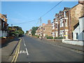
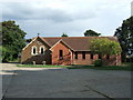
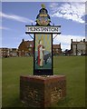
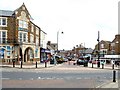
Photos of Hunstanton


Area Information
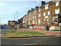
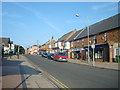
Hunstanton is a distinct built-up area encompassing 2.5 square kilometres of coastline and inland settlement in Norfolk. Living in Hunstanton offers a coastal lifestyle defined by its compact size, which concentrates the local community and services within easy reach. The area functions as a self-contained town where daily life revolves around proximity to the sea and a tight-knit neighbourhood environment. Residents benefit from a property market dominated by owner-occupiers, creating a stable residential character that differs from transient holiday towns. You will find that the town balances historical charm with modern conveniences, making it suitable for families seeking a quieter, established location. The compact footprint means that navigating the area does not require extensive travel, allowing you to maintain a straightforward routine without lengthy commutes to urban centres. This specific geographical layout supports a sense of permanence and integration within the Norfolk countryside.
- Area Type
- Built Up Area 250
- Area Size
- 2.5 km²
- Population
- Not available
- Population Density
- Not available
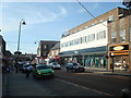
Daily life in Hunstanton is supported by a cluster of retail outlets located within practical walking or short driving distance. Five major retail venues are situated nearby, providing essential shopping options for residents. You can access a Tesco Hunstanton store and a Sainsburys Hunstanton branch for your weekly groceries and household needs. There is also a Tesco Heacham outlet available, expanding your supermarket choices beyond the immediate town centre. These specific locations mean you do not need to travel far for basic necessities, food, or household goods. The concentration of these shops creates a convenient lifestyle where errands are efficient and time is not wasted on long journeys to urban supermarkets. This proximity to major retailers like Tesco and Sainsburys ensures that the daily journey of shopping is straightforward and integrated into the fabric of the town. Living in Hunstanton allows you to manage household logistics easily while maintaining a countryside feel.
Amenities
Schools
Families considering living in Hunstanton have access to several educational institutions, all of which are listed within the immediate vicinity. For younger children, Hunstanton Infant School serves as a key primary option for the town. You will also find Smithdon Primary School operating as a local institution for early education. Hunstanton Primary School holds a specific 'good' Ofsted rating, a concrete metric that parents can use to assess educational quality directly. For older children or those seeking secondary education, Smithdon High School is available. This academy features a 'good' Ofsted rating as well, providing a verified standard of secondary education. Additionally, Glebe House School operates as an independent institution, offering an alternative curriculum path for families preferring a private education. The presence of multiple primary options combined with a trusted secondary academy ensures that you can find schools near Hunstanton without needing to commute far. This mix of community primary schools, a state academy, and an independent provider gives families a structured choice based on their specific educational philosophies.
| Rank | School | Type | Entry gender | Ages |
|---|
Explore more schools in this area
Go to Schools tabDemographics
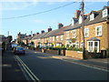
The community profile in Hunstanton reflects a mature population with a median age of 70 years. This demographic skew indicates that the area is established for older residents who often prioritise stability over rapid urban growth. Home ownership stands at 74%, a significantly high figure that underscores the area's nature as a settled residential location rather than a rental marketplace. This level of ownership suggests you are likely to buy from an existing owner, fostering a transaction built on relationship rather than speculation. The predominant household composition aligns with this age profile, typically featuring larger properties or bungalows suited to retirees. Accommodation types mirror this stability, prioritising comfort and security over high-density living. While specific ethnic diversity data is not detailed in current records, the high home ownership rate often correlates with homogeneous, long-term communities. This demographic reality means you are entering an area where residents have likely called Hunstanton home for decades, valuing tradition and quiet above the pace of big-city life.
Household Size
Accommodation Type
Tenure
Ethnic Group
Religion
Household Composition
Age
Household Deprivation
NS-SEC
Explore more demographic insights in this area
Go to Demographics tabPlanning
Planning Constraints
- Crime RiskPremium