Area Overview for HP4 3YD
Photos of HP4 3YD
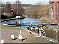

54 photos from this area
Area Information
Key information about the HP4 3YD including its size, population, and administrative classification.
- Area Type
- Postcode
- Area Size
- 7145 m²
- Population
- 1481
- Population Density
- 103 people/km²
House Prices in HP4 3YD
11
Properties
£137,095
Average Sold Price
£55,000
Lowest Price
£247,500
Highest Price
Showing 11 properties
| Address | Type | Beds | Baths | Last Sale Price | Last Sale Date | |
|---|---|---|---|---|---|---|
| 4 Old Oak Gardens, Northchurch, Berkhamsted, HP4 3YD | Flat | 1 | 1 | £247,500 | Jun 2024 | |
| 8 Old Oak Gardens, Northchurch, Berkhamsted, HP4 3YD | Maisonette | 1 | - | £205,000 | Sep 2021 | |
| 7 Old Oak Gardens, Northchurch, Berkhamsted, HP4 3YD | Flat | 1 | 1 | £117,500 | May 2019 | |
| 3 Old Oak Gardens, Northchurch, Berkhamsted, HP4 3YD | Flat | - | - | £160,000 | Feb 2014 | |
| 1 Old Oak Gardens, Northchurch, Berkhamsted, HP4 3YD | Maisonette | - | - | £160,000 | Feb 2014 | |
| 2 Old Oak Gardens, Northchurch, Berkhamsted, HP4 3YD | Flat | - | - | £158,000 | May 2012 | |
| 9 Old Oak Gardens, Northchurch, Berkhamsted, HP4 3YD | Flat | 1 | - | £55,000 | Aug 2008 | |
| 6 Old Oak Gardens, Northchurch, Berkhamsted, HP4 3YD | Flat | - | - | £104,950 | May 2008 | |
| 5 Old Oak Gardens, Northchurch, Berkhamsted, HP4 3YD | Flat | - | - | £88,000 | Jun 2004 | |
| 10 Old Oak Gardens, Northchurch, Berkhamsted, HP4 3YD | Flat | - | - | £75,000 | Feb 2004 |
Page 1 of 2
Energy Efficiency in HP4 3YD
Amenities
Schools
| Rank | School | Type | Entry gender | Ages |
|---|
Explore more schools in this area
Go to Schools tabDemographics
Household Size
Two person
most common
Accommodation Type
Houses
most common
Tenure
89
majority
Ethnic Group
White
most common
Religion
N/A
most common
Household Composition
N/A
most common
Age
47
median
Adults (30-64 years)
most common
Household Deprivation
N/A
with no deprivation
NS-SEC
48
in Lower managerial occupations
Explore more demographic insights in this area
Go to Demographics tabPlanning
Planning Constraints
- Flood RiskPremium
- Ramsar Wetland SitesPremium
- Area of Outstanding Natural BeautyPremium
- Protected Nature ReservePremium
- Protected WoodlandPremium