Area Overview for HP4 3TH
Photos of HP4 3TH
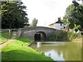
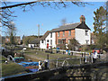
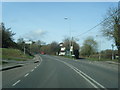
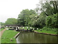
57 photos from this area
Area Information
Key information about the HP4 3TH including its size, population, and administrative classification.
- Area Type
- Postcode
- Area Size
- 1.4 hectares
- Population
- 1481
- Population Density
- 103 people/km²
House Prices in HP4 3TH
17
Properties
£560,818
Average Sold Price
£250,000
Lowest Price
£1,050,000
Highest Price
Showing 17 properties
| Address | Type | Beds | Baths | Last Sale Price | Last Sale Date | |
|---|---|---|---|---|---|---|
| 9 Boswick Lane, Dudswell, Berkhamsted, HP4 3TH | Detached | 3 | 2 | £837,000 | Aug 2024 | |
| Wisteria Cottage, 7 Boswick Lane, Dudswell, Berkhamsted, HP4 3TH | Detached | 4 | 2 | £840,000 | Feb 2023 | |
| 19 Boswick Lane, Dudswell, Berkhamsted, HP4 3TH | Detached | 4 | 2 | £1,050,000 | Feb 2023 | |
| 3 Boswick Lane, Dudswell, Berkhamsted, HP4 3TH | Detached | 4 | 2 | £800,000 | Jun 2021 | |
| 6 Boswick Lane, Dudswell, Berkhamsted, HP4 3TH | house | - | - | £455,000 | Dec 2010 | |
| 16 Boswick Lane, Dudswell, Berkhamsted, HP4 3TH | Detached | - | - | £485,000 | Sep 2009 | |
| 4 Boswick Lane, Dudswell, Berkhamsted, HP4 3TH | Detached | - | - | £400,000 | Mar 2006 | |
| 15 Boswick Lane, Dudswell, Berkhamsted, HP4 3TH | Detached | - | - | £410,000 | May 2005 | |
| 5 Boswick Lane, Dudswell, Berkhamsted, HP4 3TH | Detached | - | - | £347,000 | Jan 2002 | |
| 8 Boswick Lane, Dudswell, Berkhamsted, HP4 3TH | Detached | - | - | £295,000 | Jul 2001 |
Page 1 of 2
Energy Efficiency in HP4 3TH
Amenities
Schools
| Rank | School | Type | Entry gender | Ages |
|---|
Explore more schools in this area
Go to Schools tabDemographics
Household Size
Two person
most common
Accommodation Type
Houses
most common
Tenure
89
majority
Ethnic Group
White
most common
Religion
N/A
most common
Household Composition
N/A
most common
Age
47
median
Adults (30-64 years)
most common
Household Deprivation
N/A
with no deprivation
NS-SEC
48
in Lower managerial occupations
Explore more demographic insights in this area
Go to Demographics tabPlanning
Planning Constraints
- Flood RiskPremium
- Ramsar Wetland SitesPremium
- Area of Outstanding Natural BeautyPremium
- Protected Nature ReservePremium
- Protected WoodlandPremium