Area Overview for HP4 3NA
Photos of HP4 3NA

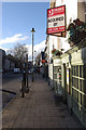
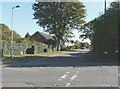
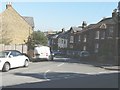
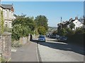
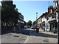
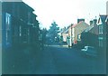
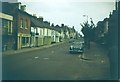
53 photos from this area
Area Information
Key information about the HP4 3NA including its size, population, and administrative classification.
- Area Type
- Postcode
- Area Size
- 4.4 hectares
- Population
- 1529
- Population Density
- 1243 people/km²
House Prices in HP4 3NA
35
Properties
£1,011,087
Average Sold Price
£232,500
Lowest Price
£2,150,000
Highest Price
Showing 35 properties
| Address | Type | Beds | Baths | Last Sale Price | Last Sale Date | |
|---|---|---|---|---|---|---|
| Winsford, Cross Oak Road, Berkhamsted, HP4 3NA | house | 5 | 4 | £2,150,000 | Aug 2024 | |
| High Oak Lodge, Cross Oak Road, Berkhamsted, HP4 3NA | house | - | - | £1,400,000 | Jul 2023 | |
| Meadow Way, Cross Oak Road, Berkhamsted, HP4 3NA | house | - | - | £1,850,000 | Feb 2021 | |
| Chertford, 126 Cross Oak Road, Berkhamsted, HP4 3NA | house | - | - | £1,487,300 | Feb 2019 | |
| Brambleway House, Cross Oak Road, Berkhamsted, HP4 3NA | house | - | - | £1,250,000 | Oct 2017 | |
| Gillams, Cross Oak Road, Berkhamsted, HP4 3NA | Detached | 5 | 3 | £1,100,000 | Aug 2015 | |
| Lavender House, Cross Oak Road, Berkhamsted, HP4 3NA | Detached | 5 | 3 | £1,275,000 | Mar 2015 | |
| Mariners, Cross Oak Road, Berkhamsted, HP4 3NA | house | - | - | £722,589 | Aug 2012 | |
| Briarclough, Cross Oak Road, Berkhamsted, HP4 3NA | house | - | - | £860,000 | Aug 2011 | |
| Charayana, Cross Oak Road, Berkhamsted, HP4 3NA | Detached | 5 | 4 | £850,000 | Oct 2009 |
Page 1 of 4
Energy Efficiency in HP4 3NA
Amenities
Schools
| Rank | School | Type | Entry gender | Ages |
|---|
Explore more schools in this area
Go to Schools tabDemographics
Household Size
Family (3-5 people)
most common
Accommodation Type
Houses
most common
Tenure
93
majority
Ethnic Group
White
most common
Religion
N/A
most common
Household Composition
N/A
most common
Age
47
median
Adults (30-64 years)
most common
Household Deprivation
N/A
with no deprivation
NS-SEC
66
in Lower managerial occupations
Explore more demographic insights in this area
Go to Demographics tabPlanning
Planning Constraints
- Flood RiskPremium
- Ramsar Wetland SitesPremium
- Area of Outstanding Natural BeautyPremium
- Protected Nature ReservePremium
- Protected WoodlandPremium