Area Overview for HP4 2QF
Photos of HP4 2QF
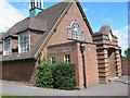
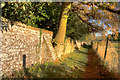
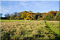
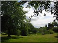
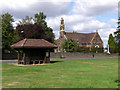


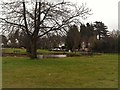


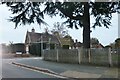
27 photos from this area
Area Information
Key information about the HP4 2QF including its size, population, and administrative classification.
- Area Type
- Postcode
- Area Size
- 96.6 hectares
- Population
- 1563
- Population Density
- 221 people/km²
House Prices in HP4 2QF
27
Properties
£1,262,778
Average Sold Price
£790,000
Lowest Price
£2,465,000
Highest Price
Showing 27 properties
| Address | Type | Beds | Baths | Last Sale Price | Last Sale Date | |
|---|---|---|---|---|---|---|
| Gutteridge Farm, Ivy House Lane, Berkhamsted, HP4 2QF | Farm | - | - | £1,750,000 | Apr 2022 | |
| Malvern House, The Common, Potten End, Berkhamsted, HP4 2QF | house | - | - | £2,465,000 | Aug 2017 | |
| Orchard Hill, The Common, Potten End, Berkhamsted, HP4 2QF | house | - | - | £1,475,000 | Sep 2015 | |
| Heather Cottage, The Common, Potten End, Berkhamsted, HP4 2QF | Detached | 5 | - | £1,050,000 | May 2010 | |
| South Winds, The Common, Potten End, Berkhamsted, HP4 2QF | Detached | - | - | £1,225,000 | Mar 2009 | |
| House In The Wood, The Common, Potten End, Berkhamsted, HP4 2QF | Detached | - | - | £805,000 | Jul 2008 | |
| Bryher, The Common, Potten End, Berkhamsted, HP4 2QF | Detached | - | - | £985,000 | Jan 2007 | |
| Pheasantries Cottage, The Common, Potten End, Berkhamsted, HP4 2QF | Detached | - | - | £820,000 | Jun 2005 | |
| Oak Lodge, The Common, Potten End, Berkhamsted, HP4 2QF | Detached | - | - | £790,000 | Jun 1997 | |
| Bremhill, The Common, Potten End, Berkhamsted, HP4 2QF | Detached | 3 | 2 | - | - |
Page 1 of 3
Energy Efficiency in HP4 2QF
Amenities
Schools
| Rank | School | Type | Entry gender | Ages |
|---|
Explore more schools in this area
Go to Schools tabDemographics
Household Size
Two person
most common
Accommodation Type
Houses
most common
Tenure
80
majority
Ethnic Group
White
most common
Religion
N/A
most common
Household Composition
N/A
most common
Age
47
median
Adults (30-64 years)
most common
Household Deprivation
N/A
with no deprivation
NS-SEC
52
in Lower managerial occupations
Explore more demographic insights in this area
Go to Demographics tabPlanning
Planning Constraints
- Flood RiskPremium
- Ramsar Wetland SitesPremium
- Area of Outstanding Natural BeautyPremium
- Protected Nature ReservePremium
- Protected WoodlandPremium