Area Overview for HP4 2LB
Photos of HP4 2LB
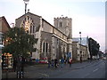
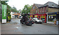
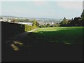
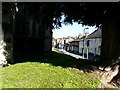
100 photos from this area
Area Information
Key information about the HP4 2LB including its size, population, and administrative classification.
- Area Type
- Postcode
- Area Size
- 2.0 hectares
- Population
- 1221
- Population Density
- 286 people/km²
House Prices in HP4 2LB
25
Properties
£654,750
Average Sold Price
£228,000
Lowest Price
£1,440,000
Highest Price
Showing 25 properties
| Address | Type | Beds | Baths | Last Sale Price | Last Sale Date | |
|---|---|---|---|---|---|---|
| 33 Cedar Road, Berkhamsted, HP4 2LB | Detached | 4 | 3 | £1,440,000 | Oct 2021 | |
| 32 Cedar Road, Berkhamsted, HP4 2LB | house | - | - | £985,000 | Sep 2021 | |
| 49 Cedar Road, Berkhamsted, HP4 2LB | Detached | 4 | 2 | £800,000 | Feb 2017 | |
| 61 Cedar Road, Berkhamsted, HP4 2LB | Detached | - | - | £855,000 | Nov 2015 | |
| 42 Cedar Road, Berkhamsted, HP4 2LB | house | - | - | £817,500 | Jul 2015 | |
| Belles Rives, 51 Cedar Road, Berkhamsted, HP4 2LB | house | - | - | £845,000 | Sep 2014 | |
| 26 Cedar Road, Berkhamsted, HP4 2LB | house | - | - | £455,000 | Aug 2011 | |
| 55 Cedar Road, Berkhamsted, HP4 2LB | Detached | - | - | £615,000 | Nov 2008 | |
| 30 Cedar Road, Berkhamsted, HP4 2LB | house | - | - | £571,500 | Apr 2008 | |
| 43 Cedar Road, Berkhamsted, HP4 2LB | Semi-detached | - | - | £600,000 | Jan 2008 |
Page 1 of 3
Energy Efficiency in HP4 2LB
Amenities
Schools
| Rank | School | Type | Entry gender | Ages |
|---|
Explore more schools in this area
Go to Schools tabDemographics
Household Size
Family (3-5 people)
most common
Accommodation Type
Houses
most common
Tenure
94
majority
Ethnic Group
White
most common
Religion
N/A
most common
Household Composition
N/A
most common
Age
47
median
Adults (30-64 years)
most common
Household Deprivation
N/A
with no deprivation
NS-SEC
59
in Lower managerial occupations
Explore more demographic insights in this area
Go to Demographics tabPlanning
Planning Constraints
- Flood RiskPremium
- Ramsar Wetland SitesPremium
- Area of Outstanding Natural BeautyPremium
- Protected Nature ReservePremium
- Protected WoodlandPremium