Area Overview for HP4 2DT
Photos of HP4 2DT

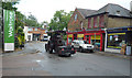


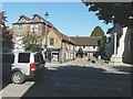


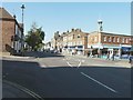


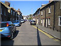
100 photos from this area
Area Information
Key information about the HP4 2DT including its size, population, and administrative classification.
- Area Type
- Postcode
- Area Size
- 1.2 hectares
- Population
- 1660
- Population Density
- 3319 people/km²
House Prices in HP4 2DT
23
Properties
£184,199
Average Sold Price
£30,000
Lowest Price
£375,000
Highest Price
Showing 23 properties
| Address | Type | Beds | Baths | Last Sale Price | Last Sale Date | |
|---|---|---|---|---|---|---|
| 12, Berkley Court, Mill Street, Berkhamsted, HP4 2DT | Flat | - | - | £235,000 | Mar 2025 | |
| 13, Berkley Court, Mill Street, Berkhamsted, HP4 2DT | Flat | - | - | £315,000 | Oct 2023 | |
| 1, Berkley Court, Mill Street, Berkhamsted, HP4 2DT | Flat | - | - | £375,000 | Apr 2023 | |
| 7, Berkley Court, Mill Street, Berkhamsted, HP4 2DT | Flat | - | - | £173,332 | Jul 2022 | |
| 3, Berkley Court, Mill Street, Berkhamsted, HP4 2DT | Flat | - | - | £30,000 | Aug 2016 | |
| 15, Berkley Court, Mill Street, Berkhamsted, HP4 2DT | Flat | - | - | £112,500 | Jul 2014 | |
| 5, Berkley Court, Mill Street, Berkhamsted, HP4 2DT | Flat | - | - | £222,500 | Mar 2014 | |
| 18, Berkley Court, Mill Street, Berkhamsted, HP4 2DT | Flat | - | - | £269,950 | Oct 2013 | |
| 16, Berkley Court, Mill Street, Berkhamsted, HP4 2DT | Flat | - | - | £160,000 | Jan 2013 | |
| 10, Berkley Court, Mill Street, Berkhamsted, HP4 2DT | Flat | - | - | £87,500 | Dec 2010 |
Page 1 of 3
Energy Efficiency in HP4 2DT
Amenities
Schools
| Rank | School | Type | Entry gender | Ages |
|---|
Explore more schools in this area
Go to Schools tabDemographics
Household Size
One person
most common
Accommodation Type
Houses
most common
Tenure
53
majority
Ethnic Group
White
most common
Religion
N/A
most common
Household Composition
N/A
most common
Age
47
median
Adults (30-64 years)
most common
Household Deprivation
N/A
with no deprivation
NS-SEC
55
in Lower managerial occupations
Explore more demographic insights in this area
Go to Demographics tabPlanning
Planning Constraints
- Flood RiskPremium
- Ramsar Wetland SitesPremium
- Area of Outstanding Natural BeautyPremium
- Protected Nature ReservePremium
- Protected WoodlandPremium