Area Overview for HP4 1LU
Photos of HP4 1LU
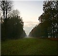
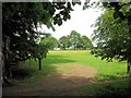
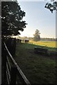
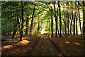
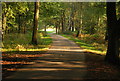
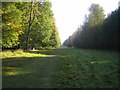
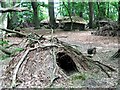
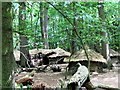
18 photos from this area
Area Information
Key information about the HP4 1LU including its size, population, and administrative classification.
- Area Type
- Postcode
- Area Size
- 73.7 hectares
- Population
- 1133
- Population Density
- 100 people/km²
House Prices in HP4 1LU
14
Properties
£2,403,750
Average Sold Price
£1,800,000
Lowest Price
£2,980,000
Highest Price
Showing 14 properties
| Address | Type | Beds | Baths | Last Sale Price | Last Sale Date | |
|---|---|---|---|---|---|---|
| The Wood, Ringshall Road, Ringshall, Berkhamsted, HP4 1LU | Detached | 6 | 4 | £2,635,000 | Dec 2025 | |
| Theccans, Ringshall Road, Ringshall, Berkhamsted, HP4 1LU | house | - | - | £2,980,000 | Jan 2021 | |
| Thunderdell, Ringshall Road, Ringshall, Berkhamsted, HP4 1LU | Detached | 6 | 5 | £2,200,000 | Nov 2020 | |
| Princes Riding, Ringshall Road, Ringshall, Berkhamsted, HP4 1LU | Detached | 6 | 5 | £1,800,000 | Jun 2015 | |
| Ringshall Rise, Ringshall Road, Ringshall, Berkhamsted, HP4 1LU | Detached | 6 | - | - | - | |
| Bridgewater House, Ringshall Road, Ringshall, Berkhamsted, HP4 1LU | house | - | - | - | - | |
| Stag Wood, Ringshall Road, Ringshall, Berkhamsted, HP4 1LU | Detached | - | - | - | - | |
| Foresters Lodge, Ringshall Road, Ringshall, Berkhamsted, HP4 1LU | house | - | - | - | - | |
| 3, Greenkeepers Cottages, Ashridge Park, Little Gaddesden, Berkhamsted, HP4 1LU | Detached | - | - | - | - | |
| Greenacre, Ringshall Road, Ringshall, Berkhamsted, HP4 1LU | Detached | - | - | - | - |
Page 1 of 2
Energy Efficiency in HP4 1LU
Amenities
Schools
| Rank | School | Type | Entry gender | Ages |
|---|
Explore more schools in this area
Go to Schools tabDemographics
Household Size
Two person
most common
Accommodation Type
Houses
most common
Tenure
81
majority
Ethnic Group
White
most common
Religion
N/A
most common
Household Composition
N/A
most common
Age
47
median
Adults (30-64 years)
most common
Household Deprivation
N/A
with no deprivation
NS-SEC
51
in Lower managerial occupations
Explore more demographic insights in this area
Go to Demographics tabPlanning
Planning Constraints
- Flood RiskPremium
- Ramsar Wetland SitesPremium
- Area of Outstanding Natural BeautyPremium
- Protected Nature ReservePremium
- Protected WoodlandPremium