Area Overview for HP4 1DJ
Photos of HP4 1DJ
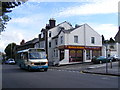
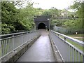
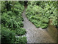
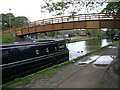
100 photos from this area
Area Information
Key information about the HP4 1DJ including its size, population, and administrative classification.
- Area Type
- Postcode
- Area Size
- 3037 m²
- Population
- 1681
- Population Density
- 4568 people/km²
House Prices in HP4 1DJ
14
Properties
£320,667
Average Sold Price
£114,000
Lowest Price
£577,000
Highest Price
Showing 14 properties
| Address | Type | Beds | Baths | Last Sale Price | Last Sale Date | |
|---|---|---|---|---|---|---|
| 63 Gossoms End, Berkhamsted, HP4 1DJ | Terraced | 2 | 1 | £487,500 | Jul 2025 | |
| 69 Gossoms End, Berkhamsted, HP4 1DJ | Terraced | 2 | 1 | £500,000 | Oct 2024 | |
| 74 Gossoms End, Berkhamsted, HP4 1DJ | Terraced | 2 | 1 | £447,000 | Jun 2024 | |
| 75 Gossoms End, Berkhamsted, HP4 1DJ | Terraced | 2 | 1 | £335,000 | May 2023 | |
| 65 Gossoms End, Berkhamsted, HP4 1DJ | Terraced | 3 | 1 | £577,000 | Jul 2022 | |
| 76 Gossoms End, Berkhamsted, HP4 1DJ | house | - | - | £267,000 | Apr 2012 | |
| 71 Gossoms End, Berkhamsted, HP4 1DJ | house | - | - | £220,000 | Mar 2011 | |
| 64 Gossoms End, Berkhamsted, HP4 1DJ | house | - | - | £230,000 | Jul 2010 | |
| 70 Gossoms End, Berkhamsted, HP4 1DJ | house | - | - | £278,000 | Jun 2010 | |
| 73 Gossoms End, Berkhamsted, HP4 1DJ | Semi-detached | 2 | 1 | £220,000 | Jul 2006 |
Page 1 of 2
Energy Efficiency in HP4 1DJ
Amenities
Schools
| Rank | School | Type | Entry gender | Ages |
|---|
Explore more schools in this area
Go to Schools tabDemographics
Household Size
One person
most common
Accommodation Type
Houses
most common
Tenure
67
majority
Ethnic Group
White
most common
Religion
N/A
most common
Household Composition
N/A
most common
Age
47
median
Adults (30-64 years)
most common
Household Deprivation
N/A
with no deprivation
NS-SEC
54
in Lower managerial occupations
Explore more demographic insights in this area
Go to Demographics tabPlanning
Planning Constraints
- Flood RiskPremium
- Ramsar Wetland SitesPremium
- Area of Outstanding Natural BeautyPremium
- Protected Nature ReservePremium
- Protected WoodlandPremium