Area Overview for HP4 1AJ
Photos of HP4 1AJ
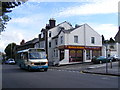
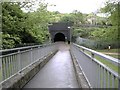
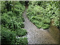
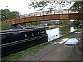
100 photos from this area
Area Information
Key information about the HP4 1AJ including its size, population, and administrative classification.
- Area Type
- Postcode
- Area Size
- 3248 m²
- Population
- 1786
- Population Density
- 6687 people/km²
House Prices in HP4 1AJ
16
Properties
£419,286
Average Sold Price
£250,000
Lowest Price
£845,000
Highest Price
Showing 16 properties
| Address | Type | Beds | Baths | Last Sale Price | Last Sale Date | |
|---|---|---|---|---|---|---|
| 283A High Street, Berkhamsted, HP4 1AJ | Flat | - | - | £350,000 | Jun 2024 | |
| 305 High Street, Berkhamsted, HP4 1AJ | house | - | - | £845,000 | Oct 2018 | |
| 291 High Street, Berkhamsted, HP4 1AJ | house | 3 | 2 | £465,000 | Nov 2017 | |
| 303 High Street, Berkhamsted, HP4 1AJ | Terraced | - | - | £415,000 | Jan 2010 | |
| 281 High Street, Berkhamsted, HP4 1AJ | Terraced | 4 | 2 | £315,000 | May 2007 | |
| 279A High Street, Berkhamsted, HP4 1AJ | Flat | 2 | 1 | £250,000 | Nov 2005 | |
| 293 High Street, Berkhamsted, HP4 1AJ | Terraced | - | - | £295,000 | Sep 2001 | |
| Milton Cottage, 287 High Street, Berkhamsted, HP4 1AJ | Terraced | 4 | 1 | - | - | |
| 305A High Street, Berkhamsted, HP4 1AJ | Flat | - | - | - | - | |
| 305B High Street, Berkhamsted, HP4 1AJ | Flat | - | - | - | - |
Page 1 of 2
Energy Efficiency in HP4 1AJ
Amenities
Schools
| Rank | School | Type | Entry gender | Ages |
|---|
Explore more schools in this area
Go to Schools tabDemographics
Household Size
Family (3-5 people)
most common
Accommodation Type
Houses
most common
Tenure
80
majority
Ethnic Group
White
most common
Religion
N/A
most common
Household Composition
N/A
most common
Age
47
median
Adults (30-64 years)
most common
Household Deprivation
N/A
with no deprivation
NS-SEC
65
in Lower managerial occupations
Explore more demographic insights in this area
Go to Demographics tabPlanning
Planning Constraints
- Flood RiskPremium
- Ramsar Wetland SitesPremium
- Area of Outstanding Natural BeautyPremium
- Protected Nature ReservePremium
- Protected WoodlandPremium