Area Overview for HP3 8PT
Photos of HP3 8PT
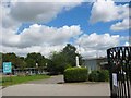
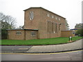
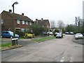
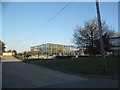

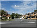
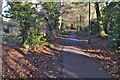
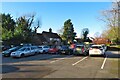
17 photos from this area
Area Information
Key information about the HP3 8PT including its size, population, and administrative classification.
- Area Type
- Postcode
- Area Size
- 1.8 hectares
- Population
- 1590
- Population Density
- 5436 people/km²
House Prices in HP3 8PT
34
Properties
£260,915
Average Sold Price
£92,000
Lowest Price
£595,000
Highest Price
Showing 34 properties
| Address | Type | Beds | Baths | Last Sale Price | Last Sale Date | |
|---|---|---|---|---|---|---|
| 43 Highland Drive, Hemel Hempstead, HP3 8PT | Flat | 2 | 1 | £245,000 | Aug 2024 | |
| 15 Highland Drive, Hemel Hempstead, HP3 8PT | Flat | - | - | £263,000 | Oct 2023 | |
| 4 Highland Drive, Hemel Hempstead, HP3 8PT | Semi-detached | 3 | 1 | £595,000 | Jan 2022 | |
| 7 Highland Drive, Hemel Hempstead, HP3 8PT | Flat | - | - | £250,000 | Oct 2021 | |
| 16 Highland Drive, Hemel Hempstead, HP3 8PT | Semi-detached | 4 | 2 | £567,000 | Jun 2021 | |
| 2A Highland Drive, Hemel Hempstead, HP3 8PT | Terraced | 5 | 3 | £440,000 | Jan 2021 | |
| 1 Highland Drive, Hemel Hempstead, HP3 8PT | Flat | - | - | £190,000 | Dec 2018 | |
| 39 Highland Drive, Hemel Hempstead, HP3 8PT | Flat | 2 | 1 | £228,000 | Oct 2018 | |
| 2 Highland Drive, Hemel Hempstead, HP3 8PT | Semi-detached | 3 | 1 | £430,000 | Jul 2018 | |
| 3 Highland Drive, Hemel Hempstead, HP3 8PT | Flat | 2 | 1 | £243,000 | Jul 2018 |
Page 1 of 4
Energy Efficiency in HP3 8PT
Amenities
Schools
| Rank | School | Type | Entry gender | Ages |
|---|
Explore more schools in this area
Go to Schools tabDemographics
Household Size
Family (3-5 people)
most common
Accommodation Type
Houses
most common
Tenure
64
majority
Ethnic Group
White
most common
Religion
N/A
most common
Household Composition
N/A
most common
Age
47
median
Adults (30-64 years)
most common
Household Deprivation
N/A
with no deprivation
NS-SEC
32
in Lower managerial occupations
Explore more demographic insights in this area
Go to Demographics tabPlanning
Planning Constraints
- Flood RiskPremium
- Ramsar Wetland SitesPremium
- Area of Outstanding Natural BeautyPremium
- Protected Nature ReservePremium
- Protected WoodlandPremium