Area Overview for HP23 5UA
Photos of HP23 5UA
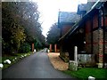
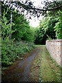
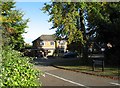
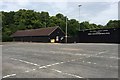
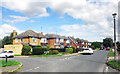
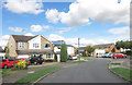
51 photos from this area
Area Information
Key information about the HP23 5UA including its size, population, and administrative classification.
- Area Type
- Postcode
- Area Size
- 4.7 hectares
- Population
- 1332
- Population Density
- 116 people/km²
House Prices in HP23 5UA
19
Properties
£836,105
Average Sold Price
£35,000
Lowest Price
£1,650,000
Highest Price
Showing 19 properties
| Address | Type | Beds | Baths | Last Sale Price | Last Sale Date | |
|---|---|---|---|---|---|---|
| 14 Damask Close, Tring, HP23 5UA | house | - | - | £1,650,000 | Jan 2023 | |
| 4 Damask Close, Tring, HP23 5UA | house | - | - | £1,410,000 | Oct 2022 | |
| Grove House, 11A Damask Close, Tring, HP23 5UA | house | - | - | £1,200,000 | Aug 2022 | |
| Rowan House, 1B Damask Close, Tring, HP23 5UA | Detached | 5 | 3 | £1,205,000 | May 2021 | |
| 17 Damask Close, Tring, HP23 5UA | Detached | 5 | 3 | £35,000 | Mar 2021 | |
| 2 Damask Close, Tring, HP23 5UA | Detached | 5 | 3 | £980,000 | Oct 2020 | |
| 1A Damask Close, Tring, HP23 5UA | Detached | 5 | 3 | £1,100,000 | Dec 2019 | |
| 5 Damask Close, Tring, HP23 5UA | Detached | 5 | 3 | £1,150,000 | Sep 2018 | |
| Damask House, 1C Damask Close, Tring, HP23 5UA | Detached | 4 | 3 | £1,070,000 | Jun 2016 | |
| 10 Damask Close, Tring, HP23 5UA | Detached | 5 | - | £1,045,000 | Jun 2016 |
Page 1 of 2
Energy Efficiency in HP23 5UA
Amenities
Schools
| Rank | School | Type | Entry gender | Ages |
|---|
Explore more schools in this area
Go to Schools tabDemographics
Household Size
Two person
most common
Accommodation Type
Houses
most common
Tenure
91
majority
Ethnic Group
White
most common
Religion
N/A
most common
Household Composition
N/A
most common
Age
47
median
Adults (30-64 years)
most common
Household Deprivation
N/A
with no deprivation
NS-SEC
55
in Lower managerial occupations
Explore more demographic insights in this area
Go to Demographics tabPlanning
Planning Constraints
- Flood RiskPremium
- Ramsar Wetland SitesPremium
- Area of Outstanding Natural BeautyPremium
- Protected Nature ReservePremium
- Protected WoodlandPremium