Area Overview for HP23 5EF
Photos of HP23 5EF

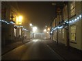
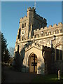
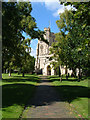
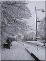

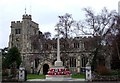
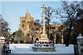
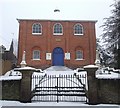
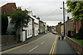
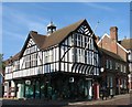
100 photos from this area
Area Information
Key information about the HP23 5EF including its size, population, and administrative classification.
- Area Type
- Postcode
- Area Size
- 2.8 hectares
- Population
- 1453
- Population Density
- 5529 people/km²
House Prices in HP23 5EF
70
Properties
£399,271
Average Sold Price
£164,000
Lowest Price
£885,000
Highest Price
Showing 70 properties
| Address | Type | Beds | Baths | Last Sale Price | Last Sale Date | |
|---|---|---|---|---|---|---|
| 19 Brook Street, Tring, HP23 5EF | Semi-detached | 3 | 2 | £560,000 | Apr 2025 | |
| 51 Brook Street, Tring, HP23 5EF | Terraced | 3 | 1 | £415,000 | Mar 2025 | |
| 73 Brook Street, Tring, HP23 5EF | Terraced | 2 | 1 | £450,000 | Dec 2024 | |
| 47 Brook Street, Tring, HP23 5EF | Terraced | 3 | 1 | £434,000 | Jun 2023 | |
| 49 Brook Street, Tring, HP23 5EF | Terraced | 3 | 1 | £415,000 | Jun 2023 | |
| 70 Brook Street, Tring, HP23 5EF | Terraced | 2 | 1 | £410,000 | Dec 2022 | |
| 25 Brook Street, Tring, HP23 5EF | Terraced | 3 | 3 | £675,000 | Dec 2022 | |
| 71 Brook Street, Tring, HP23 5EF | Terraced | 2 | - | £400,000 | Sep 2022 | |
| 22 Brook Street, Tring, HP23 5EF | Semi-detached | 3 | 2 | £725,000 | Sep 2022 | |
| 50 Brook Street, Tring, HP23 5EF | Terraced | 2 | 1 | £422,000 | Jul 2022 |
Page 1 of 7
Energy Efficiency in HP23 5EF
Amenities
Schools
| Rank | School | Type | Entry gender | Ages |
|---|
Explore more schools in this area
Go to Schools tabDemographics
Household Size
Family (3-5 people)
most common
Accommodation Type
Houses
most common
Tenure
49
majority
Ethnic Group
White
most common
Religion
N/A
most common
Household Composition
N/A
most common
Age
47
median
Adults (30-64 years)
most common
Household Deprivation
N/A
with no deprivation
NS-SEC
30
in Lower managerial occupations
Explore more demographic insights in this area
Go to Demographics tabPlanning
Planning Constraints
- Flood RiskPremium
- Ramsar Wetland SitesPremium
- Area of Outstanding Natural BeautyPremium
- Protected Nature ReservePremium
- Protected WoodlandPremium