Area Overview for HP23 4HZ
Photos of HP23 4HZ
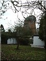
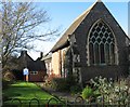
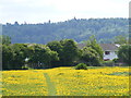
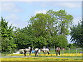
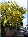
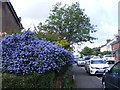
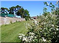

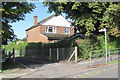
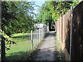
94 photos from this area
Area Information
Key information about the HP23 4HZ including its size, population, and administrative classification.
- Area Type
- Postcode
- Area Size
- 1.4 hectares
- Population
- 1527
- Population Density
- 4053 people/km²
House Prices in HP23 4HZ
18
Properties
£578,200
Average Sold Price
£137,500
Lowest Price
£960,000
Highest Price
Showing 18 properties
| Address | Type | Beds | Baths | Last Sale Price | Last Sale Date | |
|---|---|---|---|---|---|---|
| 40 Icknield Way, Tring, HP23 4HZ | Semi-detached | 4 | 2 | £895,000 | Dec 2024 | |
| 46 Icknield Way, Tring, HP23 4HZ | Semi-detached | 4 | 1 | £845,000 | May 2024 | |
| 34 Icknield Way, Tring, HP23 4HZ | Retail | 5 | 2 | £960,000 | Aug 2022 | |
| 44 Icknield Way, Tring, HP23 4HZ | house | - | - | £740,000 | Feb 2021 | |
| 48 Icknield Way, Tring, HP23 4HZ | Detached | 2 | 1 | £850,000 | Jul 2020 | |
| 58 Icknield Way, Tring, HP23 4HZ | Detached | 4 | 3 | £735,000 | Feb 2016 | |
| The Wickets, 50 Icknield Way, Tring, HP23 4HZ | Detached | 4 | - | £565,000 | Jul 2013 | |
| 56 Icknield Way, Tring, HP23 4HZ | house | - | - | £557,500 | Jan 2013 | |
| Silveridge, 42 Icknield Way, Tring, HP23 4HZ | house | - | - | £645,000 | Oct 2011 | |
| 48A Icknield Way, Tring, HP23 4HZ | house | - | - | £380,000 | Jan 2011 |
Page 1 of 2
Energy Efficiency in HP23 4HZ
Amenities
Schools
| Rank | School | Type | Entry gender | Ages |
|---|
Explore more schools in this area
Go to Schools tabDemographics
Household Size
Family (3-5 people)
most common
Accommodation Type
Houses
most common
Tenure
78
majority
Ethnic Group
White
most common
Religion
N/A
most common
Household Composition
N/A
most common
Age
47
median
Adults (30-64 years)
most common
Household Deprivation
N/A
with no deprivation
NS-SEC
46
in Lower managerial occupations
Explore more demographic insights in this area
Go to Demographics tabPlanning
Planning Constraints
- Flood RiskPremium
- Ramsar Wetland SitesPremium
- Area of Outstanding Natural BeautyPremium
- Protected Nature ReservePremium
- Protected WoodlandPremium