Area Overview for HP23 4EU
Photos of HP23 4EU
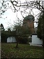
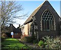
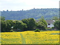
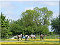
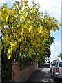
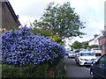
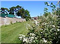

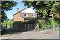
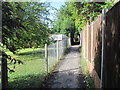
94 photos from this area
Area Information
Key information about the HP23 4EU including its size, population, and administrative classification.
- Area Type
- Postcode
- Area Size
- 2.1 hectares
- Population
- Not available
- Population Density
- Not available
House Prices in HP23 4EU
21
Properties
£591,359
Average Sold Price
£380,000
Lowest Price
£830,000
Highest Price
Showing 21 properties
| Address | Type | Beds | Baths | Last Sale Price | Last Sale Date | |
|---|---|---|---|---|---|---|
| 130 Miswell Lane, Tring, HP23 4EU | Detached | 3 | 3 | £830,000 | Jan 2025 | |
| 136 Miswell Lane, Tring, HP23 4EU | Bungalow | 4 | 2 | £655,000 | Dec 2023 | |
| 122 Miswell Lane, Tring, HP23 4EU | house | - | - | £695,000 | Sep 2021 | |
| 132 Miswell Lane, Tring, HP23 4EU | Detached | 3 | - | £630,000 | Jul 2020 | |
| 1, Counters, Miswell Lane, Tring, HP23 4EU | house | - | - | £750,000 | Jan 2019 | |
| 128 Miswell Lane, Tring, HP23 4EU | Bungalow | 3 | - | £499,950 | Sep 2014 | |
| Crossways, Miswell Lane, Tring, HP23 4EU | house | - | - | £595,000 | Dec 2013 | |
| 115 Miswell Lane, Tring, HP23 4EU | house | - | - | £435,000 | Sep 2010 | |
| 2, Counters, Miswell Lane, Tring, HP23 4EU | Detached | - | - | £615,000 | Sep 2007 | |
| 134 Miswell Lane, Tring, HP23 4EU | Detached | - | - | £420,000 | Sep 2006 |
Page 1 of 3
Energy Efficiency in HP23 4EU
Amenities
Schools
| Rank | School | Type | Entry gender | Ages |
|---|
Explore more schools in this area
Go to Schools tabDemographics
Household Size
Family (3-5 people)
most common
Accommodation Type
Houses
most common
Tenure
85
majority
Ethnic Group
White
most common
Religion
N/A
most common
Household Composition
N/A
most common
Age
47
median
Adults (30-64 years)
most common
Household Deprivation
N/A
with no deprivation
NS-SEC
48
in Lower managerial occupations
Explore more demographic insights in this area
Go to Demographics tabPlanning
Planning Constraints
- Flood RiskPremium
- Ramsar Wetland SitesPremium
- Area of Outstanding Natural BeautyPremium
- Protected Nature ReservePremium
- Protected WoodlandPremium