Area Overview for HP23 4EG
Photos of HP23 4EG
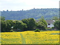
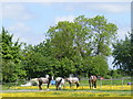
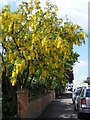
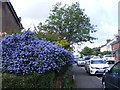

94 photos from this area
Area Information
Key information about the HP23 4EG including its size, population, and administrative classification.
- Area Type
- Postcode
- Area Size
- 1.1 hectares
- Population
- Not available
- Population Density
- Not available
House Prices in HP23 4EG
27
Properties
£266,111
Average Sold Price
£50,000
Lowest Price
£500,000
Highest Price
Showing 27 properties
| Address | Type | Beds | Baths | Last Sale Price | Last Sale Date | |
|---|---|---|---|---|---|---|
| 3 Osmington Place, Tring, HP23 4EG | Terraced | 1 | 1 | £225,000 | Nov 2024 | |
| 5 Osmington Place, Tring, HP23 4EG | Terraced | 1 | 1 | £225,000 | Oct 2024 | |
| 32 Osmington Place, Tring, HP23 4EG | Terraced | 2 | 1 | £341,000 | Jun 2021 | |
| 10 Osmington Place, Tring, HP23 4EG | Semi-detached | 3 | - | £441,000 | May 2021 | |
| 12 Osmington Place, Tring, HP23 4EG | house | - | - | £500,000 | Feb 2018 | |
| 16 Osmington Place, Tring, HP23 4EG | Semi-detached | 3 | 1 | £415,000 | Mar 2017 | |
| 6 Osmington Place, Tring, HP23 4EG | Detached | 3 | 1 | £472,500 | Mar 2016 | |
| 17 Osmington Place, Tring, HP23 4EG | Terraced | 1 | - | £147,000 | Mar 2014 | |
| 28 Osmington Place, Tring, HP23 4EG | Terraced | 3 | 2 | £413,000 | Oct 2013 | |
| 7 Osmington Place, Tring, HP23 4EG | Terraced | 1 | 1 | £125,000 | Apr 2010 |
Page 1 of 3
Energy Efficiency in HP23 4EG
Amenities
Schools
| Rank | School | Type | Entry gender | Ages |
|---|
Explore more schools in this area
Go to Schools tabDemographics
Household Size
Family (3-5 people)
most common
Accommodation Type
Houses
most common
Tenure
85
majority
Ethnic Group
White
most common
Religion
N/A
most common
Household Composition
N/A
most common
Age
47
median
Adults (30-64 years)
most common
Household Deprivation
N/A
with no deprivation
NS-SEC
48
in Lower managerial occupations
Explore more demographic insights in this area
Go to Demographics tabPlanning
Planning Constraints
- Flood RiskPremium
- Ramsar Wetland SitesPremium
- Area of Outstanding Natural BeautyPremium
- Protected Nature ReservePremium
- Protected WoodlandPremium