Area Overview for HP23 4BJ
Photos of HP23 4BJ
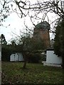
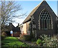
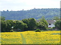
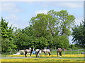
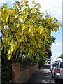
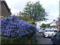
94 photos from this area
Area Information
Key information about the HP23 4BJ including its size, population, and administrative classification.
- Area Type
- Postcode
- Area Size
- 9877 m²
- Population
- 1472
- Population Density
- 693 people/km²
House Prices in HP23 4BJ
28
Properties
£613,152
Average Sold Price
£87,000
Lowest Price
£1,595,000
Highest Price
Showing 28 properties
| Address | Type | Beds | Baths | Last Sale Price | Last Sale Date | |
|---|---|---|---|---|---|---|
| 100 Western Road, Tring, HP23 4BJ | Detached | 4 | 3 | £1,140,000 | Mar 2025 | |
| 102 Western Road, Tring, HP23 4BJ | Detached | 3 | 3 | £1,030,000 | Dec 2022 | |
| 110 Western Road, Tring, HP23 4BJ | house | - | - | £700,000 | Mar 2022 | |
| 80 Western Road, Tring, HP23 4BJ | Terraced | 2 | 1 | £300,000 | Jun 2021 | |
| 94 Western Road, Tring, HP23 4BJ | Semi-detached | 6 | - | £1,595,000 | May 2021 | |
| Western House, 128A Western Road, Tring, HP23 4BJ | Semi-detached | 1 | 1 | £680,000 | Dec 2020 | |
| Lynton, 118 Western Road, Tring, HP23 4BJ | Detached | 3 | 1 | £675,000 | Dec 2020 | |
| 122 Western Road, Tring, HP23 4BJ | Semi-detached | 3 | 1 | £575,000 | Nov 2020 | |
| 98 Western Road, Tring, HP23 4BJ | Semi-detached | 4 | 1 | £835,000 | Aug 2019 | |
| 116 Western Road, Tring, HP23 4BJ | Semi-detached | 4 | 2 | £685,000 | Jun 2019 |
Page 1 of 3
Energy Efficiency in HP23 4BJ
Amenities
Schools
| Rank | School | Type | Entry gender | Ages |
|---|
Explore more schools in this area
Go to Schools tabDemographics
Household Size
Family (3-5 people)
most common
Accommodation Type
Houses
most common
Tenure
82
majority
Ethnic Group
White
most common
Religion
N/A
most common
Household Composition
N/A
most common
Age
47
median
Adults (30-64 years)
most common
Household Deprivation
N/A
with no deprivation
NS-SEC
46
in Lower managerial occupations
Explore more demographic insights in this area
Go to Demographics tabPlanning
Planning Constraints
- Flood RiskPremium
- Ramsar Wetland SitesPremium
- Area of Outstanding Natural BeautyPremium
- Protected Nature ReservePremium
- Protected WoodlandPremium