Area Overview for HP2 7QS
Photos of HP2 7QS
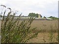
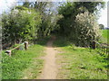
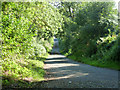
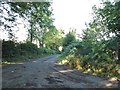
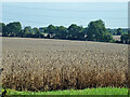
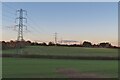
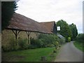
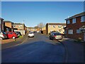

11 photos from this area
Area Information
Key information about the HP2 7QS including its size, population, and administrative classification.
- Area Type
- Postcode
- Area Size
- 6871 m²
- Population
- 1436
- Population Density
- 8368 people/km²
House Prices in HP2 7QS
25
Properties
£292,531
Average Sold Price
£63,000
Lowest Price
£547,000
Highest Price
Showing 25 properties
| Address | Type | Beds | Baths | Last Sale Price | Last Sale Date | |
|---|---|---|---|---|---|---|
| 34 Berkeley Square, Hemel Hempstead, HP2 7QS | Semi-detached | 3 | 2 | £443,000 | Jul 2025 | |
| 30 Berkeley Square, Hemel Hempstead, HP2 7QS | Terraced | 3 | 2 | £370,000 | Apr 2025 | |
| 41 Berkeley Square, Hemel Hempstead, HP2 7QS | Semi-detached | 4 | 2 | £547,000 | Mar 2025 | |
| 33 Berkeley Square, Hemel Hempstead, HP2 7QS | Semi-detached | 3 | 2 | £489,500 | Mar 2025 | |
| 45 Berkeley Square, Hemel Hempstead, HP2 7QS | house | 3 | 1 | £455,000 | Jun 2021 | |
| 46 Berkeley Square, Hemel Hempstead, HP2 7QS | Terraced | 3 | 1 | £375,000 | May 2021 | |
| 51 Berkeley Square, Hemel Hempstead, HP2 7QS | Terraced | 4 | 1 | £341,000 | Aug 2019 | |
| 39 Berkeley Square, Hemel Hempstead, HP2 7QS | Terraced | 3 | 1 | £355,000 | Oct 2016 | |
| 47 Berkeley Square, Hemel Hempstead, HP2 7QS | Terraced | 3 | - | £207,000 | Jan 2013 | |
| 50 Berkeley Square, Hemel Hempstead, HP2 7QS | Terraced | - | - | £195,000 | Oct 2009 |
Page 1 of 3
Energy Efficiency in HP2 7QS
Amenities
Schools
| Rank | School | Type | Entry gender | Ages |
|---|
Explore more schools in this area
Go to Schools tabDemographics
Household Size
One person
most common
Accommodation Type
Flats
most common
Tenure
33
majority
Ethnic Group
White
most common
Religion
N/A
most common
Household Composition
N/A
most common
Age
47
median
Adults (30-64 years)
most common
Household Deprivation
N/A
with no deprivation
NS-SEC
27
in Lower managerial occupations
Explore more demographic insights in this area
Go to Demographics tabPlanning
Planning Constraints
- Flood RiskPremium
- Ramsar Wetland SitesPremium
- Area of Outstanding Natural BeautyPremium
- Protected Nature ReservePremium
- Protected WoodlandPremium