Area Overview for HP2 7PP
Photos of HP2 7PP
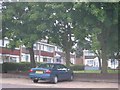
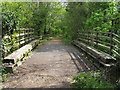

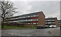

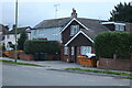
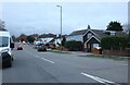
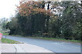
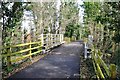
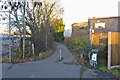
18 photos from this area
Area Information
Key information about the HP2 7PP including its size, population, and administrative classification.
- Area Type
- Postcode
- Area Size
- 5214 m²
- Population
- 1436
- Population Density
- 8368 people/km²
House Prices in HP2 7PP
21
Properties
£125,482
Average Sold Price
£45,000
Lowest Price
£211,000
Highest Price
Showing 21 properties
| Address | Type | Beds | Baths | Last Sale Price | Last Sale Date | |
|---|---|---|---|---|---|---|
| 50 Milton Dene, Hemel Hempstead, HP2 7PP | Flat | - | - | £197,000 | Oct 2024 | |
| 48 Milton Dene, Hemel Hempstead, HP2 7PP | Flat | - | - | £185,000 | May 2024 | |
| 66 Milton Dene, Hemel Hempstead, HP2 7PP | Flat | 2 | 1 | £185,000 | Mar 2022 | |
| 60 Milton Dene, Hemel Hempstead, HP2 7PP | Flat | - | - | £147,500 | Jan 2020 | |
| 46 Milton Dene, Hemel Hempstead, HP2 7PP | Flat | - | - | £210,000 | Feb 2018 | |
| 36 Milton Dene, Hemel Hempstead, HP2 7PP | Flat | - | - | £211,000 | Apr 2017 | |
| 52 Milton Dene, Hemel Hempstead, HP2 7PP | Flat | - | - | £135,000 | Dec 2015 | |
| 54 Milton Dene, Hemel Hempstead, HP2 7PP | Flat | - | - | £166,000 | Jul 2015 | |
| 72 Milton Dene, Hemel Hempstead, HP2 7PP | Flat | - | - | £110,500 | Jul 2015 | |
| 56 Milton Dene, Hemel Hempstead, HP2 7PP | Flat | - | - | £50,000 | Oct 2012 |
Page 1 of 3
Energy Efficiency in HP2 7PP
Amenities
Schools
| Rank | School | Type | Entry gender | Ages |
|---|
Explore more schools in this area
Go to Schools tabDemographics
Household Size
One person
most common
Accommodation Type
Flats
most common
Tenure
33
majority
Ethnic Group
White
most common
Religion
N/A
most common
Household Composition
N/A
most common
Age
47
median
Adults (30-64 years)
most common
Household Deprivation
N/A
with no deprivation
NS-SEC
27
in Lower managerial occupations
Explore more demographic insights in this area
Go to Demographics tabPlanning
Planning Constraints
- Flood RiskPremium
- Ramsar Wetland SitesPremium
- Area of Outstanding Natural BeautyPremium
- Protected Nature ReservePremium
- Protected WoodlandPremium