Area Overview for HP2 7NS
Photos of HP2 7NS
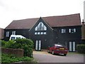
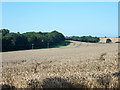
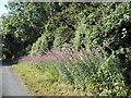
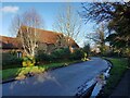
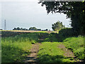
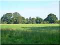
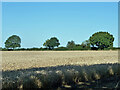
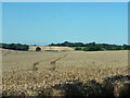
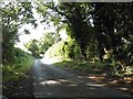
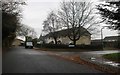
10 photos from this area
Area Information
Key information about the HP2 7NS including its size, population, and administrative classification.
- Area Type
- Postcode
- Area Size
- 9237 m²
- Population
- 1476
- Population Density
- 5627 people/km²
House Prices in HP2 7NS
27
Properties
£283,488
Average Sold Price
£75,150
Lowest Price
£485,000
Highest Price
Showing 27 properties
| Address | Type | Beds | Baths | Last Sale Price | Last Sale Date | |
|---|---|---|---|---|---|---|
| 27 Bronte Crescent, Hemel Hempstead, HP2 7NS | Terraced | 3 | 1 | £383,000 | May 2025 | |
| 11 Bronte Crescent, Hemel Hempstead, HP2 7NS | Terraced | 3 | 1 | £440,000 | Apr 2023 | |
| 19 Bronte Crescent, Hemel Hempstead, HP2 7NS | house | - | - | £340,000 | Apr 2023 | |
| 31 Bronte Crescent, Hemel Hempstead, HP2 7NS | Retail | 3 | 1 | £390,000 | Nov 2022 | |
| 45 Bronte Crescent, Hemel Hempstead, HP2 7NS | Semi-detached | 4 | 1 | £485,000 | Apr 2022 | |
| 37 Bronte Crescent, Hemel Hempstead, HP2 7NS | house | - | - | £440,000 | Apr 2022 | |
| 17 Bronte Crescent, Hemel Hempstead, HP2 7NS | Detached | 3 | 1 | £380,000 | Dec 2021 | |
| 33 Bronte Crescent, Hemel Hempstead, HP2 7NS | Terraced | 3 | 2 | £340,000 | Nov 2020 | |
| 35 Bronte Crescent, Hemel Hempstead, HP2 7NS | house | - | - | £336,085 | Dec 2019 | |
| 9A Bronte Crescent, Hemel Hempstead, HP2 7NS | Detached | 4 | 2 | £410,000 | May 2019 |
Page 1 of 3
Energy Efficiency in HP2 7NS
Amenities
Schools
| Rank | School | Type | Entry gender | Ages |
|---|
Explore more schools in this area
Go to Schools tabDemographics
Household Size
Two person
most common
Accommodation Type
Flats
most common
Tenure
60
majority
Ethnic Group
White
most common
Religion
N/A
most common
Household Composition
N/A
most common
Age
47
median
Adults (30-64 years)
most common
Household Deprivation
N/A
with no deprivation
NS-SEC
34
in Lower managerial occupations
Explore more demographic insights in this area
Go to Demographics tabPlanning
Planning Constraints
- Flood RiskPremium
- Ramsar Wetland SitesPremium
- Area of Outstanding Natural BeautyPremium
- Protected Nature ReservePremium
- Protected WoodlandPremium