Area Overview for HP2 7ND
Photos of HP2 7ND
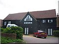
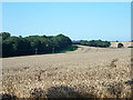
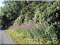
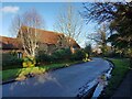
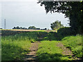
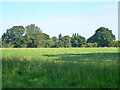
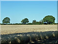
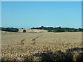
10 photos from this area
Area Information
Key information about the HP2 7ND including its size, population, and administrative classification.
- Area Type
- Postcode
- Area Size
- 1.0 hectares
- Population
- 1238
- Population Density
- 5635 people/km²
House Prices in HP2 7ND
28
Properties
£288,202
Average Sold Price
£64,000
Lowest Price
£590,000
Highest Price
Showing 28 properties
| Address | Type | Beds | Baths | Last Sale Price | Last Sale Date | |
|---|---|---|---|---|---|---|
| 59 Perry Green, Hemel Hempstead, HP2 7ND | Detached | 4 | 1 | £520,000 | Aug 2025 | |
| 50 Perry Green, Hemel Hempstead, HP2 7ND | Terraced | 3 | 1 | £382,000 | Jul 2025 | |
| 36 Perry Green, Hemel Hempstead, HP2 7ND | Semi-detached | 3 | 1 | £410,000 | Sep 2024 | |
| 58 Perry Green, Hemel Hempstead, HP2 7ND | Detached | 4 | 1 | £590,000 | Jan 2024 | |
| 41 Perry Green, Hemel Hempstead, HP2 7ND | house | 3 | 1 | £378,000 | Oct 2022 | |
| 49 Perry Green, Hemel Hempstead, HP2 7ND | Retail | 3 | 1 | £337,000 | May 2022 | |
| 37 Perry Green, Hemel Hempstead, HP2 7ND | Terraced | 3 | 1 | £387,000 | Feb 2022 | |
| 48 Perry Green, Hemel Hempstead, HP2 7ND | Terraced | 3 | 1 | £310,000 | Jan 2020 | |
| 42 Perry Green, Hemel Hempstead, HP2 7ND | Terraced | 3 | 1 | £310,000 | Aug 2018 | |
| 54 Perry Green, Hemel Hempstead, HP2 7ND | Terraced | 3 | - | £320,000 | May 2017 |
Page 1 of 3
Energy Efficiency in HP2 7ND
Amenities
Schools
| Rank | School | Type | Entry gender | Ages |
|---|
Explore more schools in this area
Go to Schools tabDemographics
Household Size
Family (3-5 people)
most common
Accommodation Type
Houses
most common
Tenure
85
majority
Ethnic Group
White
most common
Religion
N/A
most common
Household Composition
N/A
most common
Age
47
median
Adults (30-64 years)
most common
Household Deprivation
N/A
with no deprivation
NS-SEC
38
in Lower managerial occupations
Explore more demographic insights in this area
Go to Demographics tabPlanning
Planning Constraints
- Flood RiskPremium
- Ramsar Wetland SitesPremium
- Area of Outstanding Natural BeautyPremium
- Protected Nature ReservePremium
- Protected WoodlandPremium