Area Overview for HP2 5HJ
Photos of HP2 5HJ

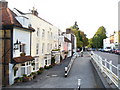

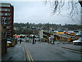
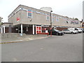
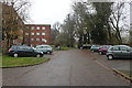
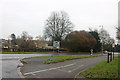
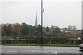
100 photos from this area
Area Information
Key information about the HP2 5HJ including its size, population, and administrative classification.
- Area Type
- Postcode
- Area Size
- 1.7 hectares
- Population
- 1670
- Population Density
- 1440 people/km²
House Prices in HP2 5HJ
64
Properties
£428,783
Average Sold Price
£64,000
Lowest Price
£750,000
Highest Price
Showing 64 properties
| Address | Type | Beds | Baths | Last Sale Price | Last Sale Date | |
|---|---|---|---|---|---|---|
| 5, The Old School House, George Street, Hemel Hempstead, HP2 5HJ | Flat | - | - | £214,000 | Jul 2025 | |
| 31 George Street, Hemel Hempstead, HP2 5HJ | house | 3 | 1 | £580,000 | Feb 2025 | |
| 17 George Street, Hemel Hempstead, HP2 5HJ | Detached | 4 | 2 | £590,000 | Jan 2025 | |
| 23 George Street, Hemel Hempstead, HP2 5HJ | Semi-detached | 3 | 1 | £430,000 | Aug 2023 | |
| 35 George Street, Hemel Hempstead, HP2 5HJ | Semi-detached | 4 | 2 | £580,000 | Jun 2023 | |
| 15 George Street, Hemel Hempstead, HP2 5HJ | Detached | 3 | 1 | £603,000 | Aug 2022 | |
| 33 George Street, Hemel Hempstead, HP2 5HJ | Semi-detached | 4 | 2 | £675,000 | Aug 2022 | |
| 22 George Street, Hemel Hempstead, HP2 5HJ | house | 4 | 1 | £503,500 | Aug 2022 | |
| 26 George Street, Hemel Hempstead, HP2 5HJ | Retail | 2 | 1 | £415,000 | May 2022 | |
| 20 George Street, Hemel Hempstead, HP2 5HJ | Detached | 4 | 2 | £750,000 | Mar 2022 |
Page 1 of 7
Energy Efficiency in HP2 5HJ
Amenities
Schools
| Rank | School | Type | Entry gender | Ages |
|---|
Explore more schools in this area
Go to Schools tabDemographics
Household Size
One person
most common
Accommodation Type
Houses
most common
Tenure
54
majority
Ethnic Group
White
most common
Religion
N/A
most common
Household Composition
N/A
most common
Age
47
median
Adults (30-64 years)
most common
Household Deprivation
N/A
with no deprivation
NS-SEC
41
in Lower managerial occupations
Explore more demographic insights in this area
Go to Demographics tabPlanning
Planning Constraints
- Flood RiskPremium
- Ramsar Wetland SitesPremium
- Area of Outstanding Natural BeautyPremium
- Protected Nature ReservePremium
- Protected WoodlandPremium