Area Overview for HP2 4BW
Photos of HP2 4BW
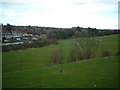
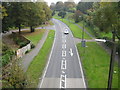
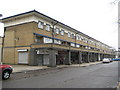
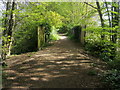
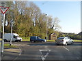
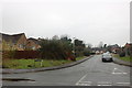
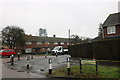
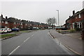
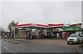
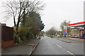
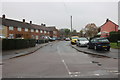
24 photos from this area
Area Information
Key information about the HP2 4BW including its size, population, and administrative classification.
- Area Type
- Postcode
- Area Size
- 2.1 hectares
- Population
- 1823
- Population Density
- 5154 people/km²
House Prices in HP2 4BW
50
Properties
£230,283
Average Sold Price
£60,000
Lowest Price
£375,000
Highest Price
Showing 50 properties
| Address | Type | Beds | Baths | Last Sale Price | Last Sale Date | |
|---|---|---|---|---|---|---|
| 96 Windmill Road, Hemel Hempstead, HP2 4BW | Terraced | 3 | 1 | £375,000 | Jun 2019 | |
| 128A Windmill Road, Hemel Hempstead, HP2 4BW | Terraced | 3 | - | £285,000 | May 2019 | |
| 67 Windmill Road, Hemel Hempstead, HP2 4BW | Terraced | 3 | 1 | £350,000 | Mar 2019 | |
| 89 Windmill Road, Hemel Hempstead, HP2 4BW | Terraced | 3 | 1 | £325,000 | Jul 2017 | |
| 138 Windmill Road, Hemel Hempstead, HP2 4BW | Terraced | 3 | 1 | £367,500 | Jul 2017 | |
| 81 Windmill Road, Hemel Hempstead, HP2 4BW | Terraced | 3 | 1 | £270,000 | Jun 2015 | |
| 116 Windmill Road, Hemel Hempstead, HP2 4BW | Terraced | 4 | - | £280,000 | Jun 2013 | |
| 75 Windmill Road, Hemel Hempstead, HP2 4BW | house | - | - | £250,000 | Dec 2009 | |
| 83 Windmill Road, Hemel Hempstead, HP2 4BW | Terraced | - | - | £210,000 | Apr 2008 | |
| 94 Windmill Road, Hemel Hempstead, HP2 4BW | house | 5 | 1 | £200,000 | Nov 2006 |
Page 1 of 5
Energy Efficiency in HP2 4BW
Amenities
Schools
| Rank | School | Type | Entry gender | Ages |
|---|
Explore more schools in this area
Go to Schools tabDemographics
Household Size
Family (3-5 people)
most common
Accommodation Type
Houses
most common
Tenure
53
majority
Ethnic Group
White
most common
Religion
N/A
most common
Household Composition
N/A
most common
Age
47
median
Adults (30-64 years)
most common
Household Deprivation
N/A
with no deprivation
NS-SEC
27
in Lower managerial occupations
Explore more demographic insights in this area
Go to Demographics tabPlanning
Planning Constraints
- Flood RiskPremium
- Ramsar Wetland SitesPremium
- Area of Outstanding Natural BeautyPremium
- Protected Nature ReservePremium
- Protected WoodlandPremium