Area Overview for HP1 3SZ
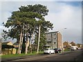
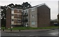
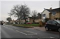
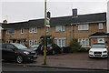
Photos of HP1 3SZ


Area Information
HP1 3SZ is a small residential cluster in England with a population of 1853, characterised by a quiet, established feel. The area is predominantly composed of houses, reflecting a community of settled residents. With a median age of 47 and a majority of adults aged 30–64, it caters to families and professionals seeking stability. Daily life here is shaped by proximity to local amenities and transport links. Residents benefit from nearby rail stations, including Hemel Hempstead and Berkhamsted, which connect to major routes. The area’s small size means it is not densely populated, offering a sense of space without the congestion of larger towns. For those prioritising convenience, essential retail outlets like Tesco Warners and Asda Dacorum are within practical reach. While the area lacks sprawling green spaces or cultural hubs, its compact nature ensures a straightforward lifestyle, ideal for those valuing accessibility over urban vibrancy.
- Area Type
- Postcode
- Area Size
- Not available
- Population
- 1853
- Population Density
- 5230 people/km²
The property market in HP1 3SZ is characterised by a 43% home ownership rate, suggesting that nearly half of properties are rented. This points to a rental market that may cater to younger professionals or those seeking temporary housing. The area’s accommodation type is predominantly houses, which are typically larger and more suited to families than to investors or first-time buyers. Given the small size of the postcode, the housing stock is limited, meaning buyers may need to look beyond HP1 3SZ for a wider selection. The presence of houses also implies that the area is less likely to feature high-density developments. For those considering purchase, the market’s modest scale and focus on individual homes suggest a niche appeal, particularly for those prioritising space and privacy over proximity to urban centres.
House Prices in HP1 3SZ
No properties found in this postcode.
Energy Efficiency in HP1 3SZ
The lifestyle in HP1 3SZ is shaped by its proximity to essential retail and transport hubs. Local shops such as Tesco Warners, Asda Dacorum, and Co-op Long provide everyday convenience, reducing the need for long trips to larger centres. The area’s rail stations, including Hemel Hempstead and Apsley, offer easy access to nearby towns, supporting both commuting and leisure travel. While there is no mention of parks or leisure facilities in the data, the presence of multiple retail outlets and transport links suggests a practical, no-frills lifestyle. Residents can enjoy a straightforward routine, with shopping and travel needs met within a short distance. The compact nature of the area means amenities are concentrated, which may appeal to those seeking simplicity over sprawling urban offerings.
Amenities
Schools
The nearest school to HP1 3SZ is Micklem Primary School, which serves the local community with a good Ofsted rating. This primary school is a key asset for families, offering a reliable foundation for early education. However, the absence of secondary schools in the immediate vicinity means parents may need to consider commuting to nearby towns for secondary education. The single school listed reflects the area’s small size, which limits the range of educational options. For families prioritising a strong primary education, Micklem Primary School provides a solid start, but those requiring a full spectrum of schooling should factor in travel time to larger centres. The school’s good rating underscores the potential for quality education, though it does not address broader needs beyond primary level.
| Rank | School | Type | Entry gender | Ages |
|---|
Explore more schools in this area
Go to Schools tabDemographics
The population of HP1 3SZ skews towards adults aged 30–64, with a median age of 47. This suggests a mature, stable community, likely comprising families and professionals in mid-career. Home ownership rates stand at 43%, indicating a mix of owner-occupied properties and rentals. The predominant accommodation type is houses, reflecting a preference for private, spacious living. The area’s demographic profile is largely homogenous, with the White ethnic group forming the majority. This composition may influence local social dynamics, fostering a sense of continuity and familiarity. However, the lack of detailed data on deprivation or diversity means the area’s broader socioeconomic context remains less defined. For residents, the age profile implies a balance between generational stability and potential demand for services catering to older adults.
Household Size
Accommodation Type
Tenure
Ethnic Group
Religion
Household Composition
Age
Household Deprivation
NS-SEC
Explore more demographic insights in this area
Go to Demographics tabPlanning
Planning Constraints
- Flood RiskPremium
- Ramsar Wetland SitesPremium
- Area of Outstanding Natural BeautyPremium
- Protected Nature ReservePremium
- Protected WoodlandPremium